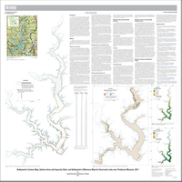
Bathymetric contour map, surface area and capacity table, and bathymetric difference map for Clearwater Lake near Piedmont, Missouri, 2017
Links
- Sheet: Map (9.56 MB pdf)
- Data Release: USGS data release - Bathymetric data for Clearwater Lake near Piedmont, Missouri, 2017
- Download citation as: RIS | Dublin Core
Abstract
Suggested Citation
Richards, J.M., and Huizinga, R.J., 2018, Bathymetric contour map, surface area and capacity table, and bathymetric difference map for Clearwater Lake near Piedmont, Missouri, 2017: U.S. Geological Survey Scientific Investigations Map 3409, 1 sheet, https://doi.org/10.3133/sim3409.
ISSN: 2329-132X (online)
Study Area
Table of Contents
- Introduction
- Methods
- Bathymetric Data Collection Quality Assurance
- Bathymetric Surface and Contour Map Quality Assurance
- Bathymetry, Capacity, and Bathymetric Change
- References Cited
| Publication type | Report |
|---|---|
| Publication Subtype | USGS Numbered Series |
| Title | Bathymetric contour map, surface area and capacity table, and bathymetric difference map for Clearwater Lake near Piedmont, Missouri, 2017 |
| Series title | Scientific Investigations Map |
| Series number | 3409 |
| DOI | 10.3133/sim3409 |
| Publication Date | June 19, 2018 |
| Year Published | 2018 |
| Language | English |
| Publisher | U.S. Geological Survey |
| Publisher location | Reston, VA |
| Contributing office(s) | Missouri Water Science Center |
| Description | Sheet: 36.0 x 36.0 inches; Data Release |
| Country | United States |
| State | Missouri |
| City | Piedmont |
| Other Geospatial | Clearwater Lake |
| Online Only (Y/N) | Y |
| Additional Online Files (Y/N) | Y |


