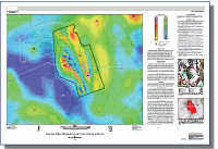
Aeromagnetic map of Mountain Pass and vicinity, California and Nevada
Links
- Document: Report (19 MB pdf)
- Larger Work: This publication is Chapter B of Geophysical and geologic maps of Mountain Pass and vicinity, California and Nevada
- Data Release: USGS Data Release - High-resolution aeromagnetic survey of Mountain Pass, California
- Download citation as: RIS | Dublin Core
Abstract
Magnetic investigations of Mountain Pass and vicinity were begun as part of an effort to study regional crustal structures as an aid to understanding the geologic framework and mineral resources of the eastern Mojave Desert. The study area, which straddles the state boundary between southeastern California and southern Nevada, encompasses Mountain Pass, which is host to one of the world’s largest rare earth element carbonatite deposits.
The deposit is found along a north-northwest-trending, fault-bounded block that extends along the eastern parts of the Clark Mountain Range, Mescal Range, and Ivanpah Mountains. This Paleoproterozoic block is composed of a 1.7-Ga metamorphic complex of gneiss and schist that underwent widespread metamorphism and associated plutonism during the Ivanpah orogeny. The Paleoproterozoic rocks were intruded by a Mesoproterozoic (1.4 Ga) ultrapotassic alkaline intrusive suite and carbonatite body. The intrusive rocks include, from oldest to youngest, shonkinite, mesosyenite, syenite, quartz syenite, potassic granite, carbonatite, carbonatite dikes, and late shonkinite dikes.
Generally speaking, magnetic anomalies reflect lateral changes in subsurface magnetization that can be used to infer subsurface geologic structure, revealing variations in lithology and delineating geologic features such as faults, plutons, volcanic rocks, calderas, and sedimentary basins.
A regional aeromagnetic map was derived from statewide aeromagnetic maps of California and Nevada that were compiled from numerous surveys flown at various flightline altitudes and spacings. This compilation, although composed of surveys acquired using different specifications, allows seamless interpretation of magnetic anomalies across survey boundaries.
In addition, a high-resolution aeromagnetic survey was flown by helicopter over parts of the Clark Mountain Range, Mescal Range, and Ivanpah Mountains. The resulting mapped magnetic anomalies show in much greater detail the complex subsurface structures in the Mountain Pass area.
Suggested Citation
Ponce, D.A., and Denton, K.M. (D.A. Ponce, ed.), 2018, Aeromagnetic map of Mountain Pass and vicinity, California and Nevada: U.S. Geological Survey Scientific Investigations Map 3412–B, scale 1:62,500, https://doi.org/10.3133/sim3412B.
ISSN: 2329-132X (online)
Study Area
| Publication type | Report |
|---|---|
| Publication Subtype | USGS Numbered Series |
| Title | Aeromagnetic map of Mountain Pass and vicinity, California and Nevada |
| Series title | Scientific Investigations Map |
| Series number | 3412 |
| Chapter | B |
| DOI | 10.3133/sim3412B |
| Publication Date | October 11, 2018 |
| Year Published | 2018 |
| Language | English |
| Publisher | U.S. Geological Survey |
| Publisher location | Reston, VA |
| Contributing office(s) | Geology, Minerals, Energy, and Geophysics Science Center |
| Description | Sheet: 44.05 x 30.24 inches; Data Releases |
| Country | United States |
| State | California, Nevada |
| Other Geospatial | Mountain Pass |
| Online Only (Y/N) | Y |
| Additional Online Files (Y/N) | Y |


