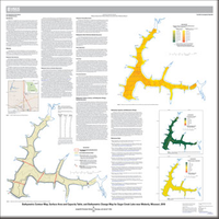
Bathymetric Contour Map, Surface Area and Capacity Table, and Bathymetric Change Map for Sugar Creek Lake near Moberly, Missouri, 2018
Links
- Sheet: Report (2.21 MB pdf)
- Data Release: USGS data release - Bathymetric and supporting data for Sugar Creek Lake near Moberly, Missouri, 2018
- Download citation as: RIS | Dublin Core
Abstract
Suggested Citation
Richards, J.M., Huizinga, R.J., and Ellis, J.T., 2019, Bathymetric contour map, surface area and capacity table, and bathymetric change map for Sugar Creek Lake near Moberly, Missouri, 2018: U.S. Geological Survey Scientific Investigations Map 3431, 1 sheet, https://doi.org/10.3133/sim3431.
ISSN: 2329-132X (online)
Study Area
Table of Contents
- Introduction
- Methods
- Bathymetric Data Collection Quality Assurance
- Bathymetric Surface, Contour, and Bathymetric Change Quality Assurance
- Bathymetry, Capacity, and Bathymetric Change
- References Cited
| Publication type | Report |
|---|---|
| Publication Subtype | USGS Numbered Series |
| Title | Bathymetric contour map, surface area and capacity table, and bathymetric change map for Sugar Creek Lake near Moberly, Missouri, 2018 |
| Series title | Scientific Investigations Map |
| Series number | 3431 |
| DOI | 10.3133/sim3431 |
| Publication Date | April 04, 2019 |
| Year Published | 2019 |
| Language | English |
| Publisher | U.S. Geological Survey |
| Publisher location | Reston, VA |
| Contributing office(s) | Central Midwest Water Science Center |
| Description | Sheet: 36.0 x 36.0 inches; Data Release |
| Country | United States |
| State | Missouri |
| Other Geospatial | Sugar Creek Lake |
| Online Only (Y/N) | Y |


