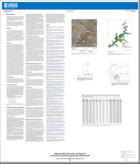
Bathymetric Map, Surface Area, and Capacity of Grand Lake O’ the Cherokees, Northeastern Oklahoma, 2019
Links
- Sheets:
- Data Release: USGS data release - Data release of bathymetric map, surface area, and capacity of Grand Lake O’ the Cherokees, northeastern Oklahoma, 2019
- Download citation as: RIS | Dublin Core
Abstract
The U.S. Geological Survey (USGS), in cooperation with the Grand River Dam Authority, completed a high-resolution multibeam bathymetric survey to compute a new area and capacity table for Grand Lake O’ the Cherokees in northeastern Oklahoma. Area and capacity tables identify the relation between the elevation of the water surface and the volume of water that can be impounded at each water-surface elevation. The area and capacity of Grand Lake O’ the Cherokees were computed from a triangular irregular network surface created in Global Mapper Version 21.0.1. The triangular irregular network surface was created from three datasets: (1) a multibeam mapping system bathymetric survey of Grand Lake O’ the Cherokees completed during April–July 2019, (2) a previous bathymetric survey of the Neosho, Spring, and Elk Rivers, and (3) a 2010 USGS lidar-derived digital elevation model. The digital elevation model data were used in areas with land-surface elevations greater than 744 feet above the North American Vertical Datum of 1988 where the multibeam sonar data could not be collected. The 2019 multibeam sonar data were the predominant data used to compute the new area and capacity table for Grand Lake O’ the Cherokees.
Suggested Citation
Hunter, S.L., Trevisan, A.R., Villa, J., and Smith, K.A., 2020, Bathymetric map, surface area, and capacity of Grand Lake O’ the Cherokees, northeastern Oklahoma, 2019: U.S. Geological Survey Scientific Investigations Map 3467, 2 sheets, https://doi.org/10.3133/sim3467.
ISSN: 2329-132X (online)
Study Area
Table of Contents
- Acknowledgments
- Abstract
- Introduction
- Purpose and Scope
- Description of the Study Area
- Methods of Bathymetric Survey and Data Analysis
- Bathymetric Data-Collection Quality Assurance
- Bathymetric Surface and Contour Quality Assurance
- Bathymetry, Surface Area, and Capacity Results
- References
| Publication type | Report |
|---|---|
| Publication Subtype | USGS Numbered Series |
| Title | Bathymetric map, surface area, and capacity of Grand Lake O’ the Cherokees, northeastern Oklahoma, 2019 |
| Series title | Scientific Investigations Map |
| Series number | 3467 |
| DOI | 10.3133/sim3467 |
| Publication Date | December 21, 2020 |
| Year Published | 2020 |
| Language | English |
| Publisher | U.S. Geological Survey |
| Publisher location | Reston, VA |
| Contributing office(s) | Oklahoma-Texas Water Science Center |
| Description | 2 Sheets: 36.00 x 42.00 inches; Data Release |
| Country | United States |
| State | Oklahoma |
| Other Geospatial | Grand Lake O’ the Cherokees |
| Online Only (Y/N) | Y |


