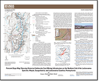
Percent-Slope Map Showing Historical Anthracite Coal-Mining Infrastructure at the Northern End of the Lackawanna Syncline, Wayne, Susquehanna, and Lackawanna Counties, Pennsylvania
Links
- Sheet: Report (41.9 MB pdf)
- Data Release: USGS data release - Database of historical anthracite coal-mining infrastructure at the northern end of the Lackawanna syncline, Wayne, Susquehanna, and Lackawanna counties, Pennsylvania
- NGMDB Index Page: National Geologic Map Database Index Page (html)
- Download citation as: RIS | Dublin Core
Introduction
Abandoned railroads and infrastructure from the anthracite coal-mining industry are significant features in abandoned mine lands and are an important part of history; however, these features are often lost and masked by the passage of time and the regrowth of forests. The application of modern light detection and ranging (lidar) topographic analysis, combined with field verification, enabled the mapping of these historical features. Waste rock piles and abandoned mine lands from historical mining locally appear as distinct features on the landscape depicted on the percent-slope base map. Abandoned, and in many places demolished, infrastructure such as breakers, turntables, rail beds, water tanks, tram piers, and bridge abutments, for example, were identified in the field and located with a Global Positioning System (GPS) receiver. This percent-slope map shows the locations of many of the abandoned features from the coal-mining industry near Forest City, Pennsylvania, and preserves a time that was an important part of the industrial revolution and a way of life that has been quiet for over half a century.
Suggested Citation
Walsh, G.J., and Walsh, M.C., 2023, Percent-slope map showing historical anthracite coal-mining infrastructure at the northern end of the Lackawanna syncline, Wayne, Susquehanna, and Lackawanna Counties, Pennsylvania: U.S. Geological Survey Scientific Investigations Map 3507, 1 sheet, scale 1:40,000, https://doi.org/10.3133/sim3507.
ISSN: 2329-132X (online)
Study Area
Table of Contents
- Explanation of Map Symbols
- Introduction
- Discussion
- Acknowledgments
- References Cited
| Publication type | Report |
|---|---|
| Publication Subtype | USGS Numbered Series |
| Title | Percent-slope map showing historical anthracite coal-mining infrastructure at the northern end of the Lackawanna syncline, Wayne, Susquehanna, and Lackawanna Counties, Pennsylvania |
| Series title | Scientific Investigations Map |
| Series number | 3507 |
| DOI | 10.3133/sim3507 |
| Publication Date | June 23, 2023 |
| Year Published | 2023 |
| Language | English |
| Publisher | U.S. Geological Survey |
| Publisher location | Reston, VA |
| Contributing office(s) | Florence Bascom Geoscience Center |
| Description | Sheet: 22.40 x 18.34 inches; Data Release |
| Country | United States |
| State | Pennsylvania |
| County | Lackawanna County, Susquehanna County, Wayne County |
| Online Only (Y/N) | Y |
| Additional Online Files (Y/N) | N |


