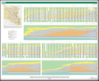
Stratigraphic Cross Sections of the Lewis Shale in the Eastern Part of the Southwestern Wyoming Province, Wyoming and Colorado
Links
- Document: Report (1.01 MB pdf) , HTML , XML
- Sheet: Sheet (14.8 MB pdf)
- Related Work: USGS data release— Digital Stratigraphic and Structural Grids of the Cretaceous Lewis Shale in the Eastern Part of the Southwestern Wyoming Province, Wyoming and Colorado
- Data Releases:
- USGS data release - Formation tops data from the stratigraphic cross sections of the Lewis Shale in the eastern part of the Southwestern Wyoming Province, Wyoming and Colorado
- USGS data release - Digital Stratigraphic and Structural Grids of the Cretaceous Lewis Shale in the Eastern Part of the Southwestern Wyoming Province, Wyoming and Colorado
- Download citation as: RIS | Dublin Core
Abstract
Three stratigraphic cross sections A–A', B–B', and C–C' were created for the Lewis Shale and associated strata in the eastern part of the Southwestern Wyoming Province of Wyoming and Colorado. The cross sections highlight 15 clinothems within the Lewis Shale, Fox Hills Sandstone, and Lance Formation progradational system (also referred to as the Lewis Shale system). Additionally, the cross sections indicate that multiple source areas were active at the same time during deposition of the Lewis Shale. Specifically, the north-to-southeast cross section A–A' demonstrates that the northern, sand-rich source was being deposited and onlapping onto an older, southern, mud-rich source.
Suggested Citation
Hearon, J.S., 2023, Stratigraphic cross sections of the Lewis Shale in the eastern part of the Southwestern Wyoming Province, Wyoming and Colorado: U.S. Geological Survey Scientific Investigations Map 3511, 1 sheet, 5-p. pamphlet, https://doi.org/10.3133/sim3511.
ISSN: 2329-132X (online)
Study Area
Table of Contents
- Abstract
- Introduction
- Data and Methods
- Paleogeography and Stratigraphy
- Discussion
- Summary
- Acknowledgments
- References Cited
| Publication type | Report |
|---|---|
| Publication Subtype | USGS Numbered Series |
| Title | Stratigraphic Cross Sections of the Lewis Shale in the Eastern Part of the Southwestern Wyoming Province, Wyoming and Colorado |
| Series title | Scientific Investigations Map |
| Series number | 3511 |
| DOI | 10.3133/sim3511 |
| Publication Date | October 30, 2023 |
| Year Published | 2023 |
| Language | English |
| Publisher | U.S. Geological Survey |
| Publisher location | Reston, VA |
| Contributing office(s) | Central Energy Resources Science Center |
| Description | Report: iv, 5 p.; 1 Sheet: 55.68 × 45.43 inches; Data Release |
| Country | United States |
| State | Colorado, Wyoming |
| Online Only (Y/N) | Y |


