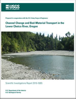
Channel change and bed-material transport in the Lower Chetco River, Oregon
Links
- More information: USGS Index Page (html)
- Download citation as: RIS | Dublin Core
Abstract
The lower Chetco River is a wandering gravel-bed river flanked by abundant and large gravel bars formed of coarse bed-material sediment. Since the early twentieth century, the large gravel bars have been a source of commercial aggregate for which ongoing permitting and aquatic habitat concerns have motivated this assessment of historical channel change and sediment transport rates. Analysis of historical channel change and bed-material transport rates for the lower 18 kilometers shows that the upper reaches of the study area are primarily transport zones, with bar positions fixed by valley geometry and active bars mainly providing transient storage of bed material. Downstream reaches, especially near the confluence of the North Fork Chetco River, are zones of active sedimentation and channel migration.
Multiple analyses, supported by direct measurements of bedload during winter 2008–09, indicate that since 1970 the mean annual flux of bed material into the study reach has been about 40,000–100,000 cubic meters per year. Downstream tributary input of bed-material sediment, probably averaging 5–30 percent of the influx coming into the study reach from upstream, is approximately balanced by bed-material attrition by abrasion. Probably little bed material leaves the lower river under natural conditions, with most net influx historically accumulating in wider and more dynamic reaches, especially near the North Fork Chetco River confluence, 8 kilometers upstream from the Pacific Ocean.
The year-to-year flux, however, varies tremendously. Some years may have less than 3,000 cubic meters of bed material entering the study area; by contrast, some high-flow years, such as 1982 and 1997, likely have more than 150,000 cubic meters entering the reach. For comparison, the estimated annual volume of gravel extracted from the lower Chetco River for commercial aggregate during 2000–2008 has ranged from 32,000 to 90,000 cubic meters and averaged about 59,000 cubic meters per year. Mined volumes probably exceeded 140,000 cubic meters per year for several years in the late 1970s.
Repeat surveys and map analyses indicate a reduction in bar area and sinuosity between 1939 and 2008, chiefly in the period 1965–95. Repeat topographic and bathymetric surveys show channel incision for substantial portions of the study reach, with local areas of bed lowering by as much as 2 meters. A specific gage analysis at the upstream end of the study reach indicates that incision and narrowing followed aggradation culminating in the late 1970s. These observations are all consistent with a reduction of sediment supply relative to transport capacity since channel surveys in the late 1970s, probably owing to a combination of (1) bed sediment removal and (2) transient river adjustments to large sediment volumes brought by floods such as those in 1964 and, to a lesser extent, 1996.
Suggested Citation
Wallick, J., Anderson, S.W., Cannon, C., O'Connor, J., 2010, Channel change and bed-material transport in the Lower Chetco River, Oregon (Version 2.0, July 2012): U.S. Geological Survey Scientific Investigations Report 2010-5065, Report: viii, 68 p. , https://doi.org/10.3133/sir20105065.
ISSN: 2328-0328 (online)
ISSN: 2328-031X (print)
Study Area
| Publication type | Report |
|---|---|
| Publication Subtype | USGS Numbered Series |
| Title | Channel change and bed-material transport in the Lower Chetco River, Oregon |
| Series title | Scientific Investigations Report |
| Series number | 2010-5065 |
| DOI | 10.3133/sir20105065 |
| Edition | Version 2.0, July 2012 |
| Year Published | 2010 |
| Language | English |
| Publisher | U.S. Geological Survey |
| Publisher location | Reston, VA |
| Contributing office(s) | Oregon Water Science Center, Volcano Hazards Program |
| Description | Report: viii, 68 p. |
| Country | United States |
| State | Oregon |
| Other Geospatial | Chetco River |
| Projection | Universal Transverse Mercator |
| Online Only (Y/N) | N |
| Additional Online Files (Y/N) | Y |


