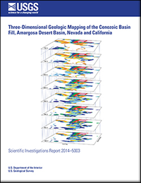
Three-dimensional geologic mapping of the Cenozoic basin fill, Amargosa Desert basin, Nevada and California
Links
- More information: USGS Index Page
- Document: Report
- Appendixes:
- Download citation as: RIS | Dublin Core
Abstract
Suggested Citation
Taylor, E.M., Sweetkind, D., 2014, Three-dimensional geologic mapping of the Cenozoic basin fill, Amargosa Desert basin, Nevada and California: U.S. Geological Survey Scientific Investigations Report 2014-5003, Report: v, 40 p.; Appendix 1: 1 XLS file; Appendix 2: XLS file, https://doi.org/10.3133/sir20145003.
ISSN: 2328-0328 (online)
Study Area
| Publication type | Report |
|---|---|
| Publication Subtype | USGS Numbered Series |
| Title | Three-dimensional geologic mapping of the Cenozoic basin fill, Amargosa Desert basin, Nevada and California |
| Series title | Scientific Investigations Report |
| Series number | 2014-5003 |
| DOI | 10.3133/sir20145003 |
| Year Published | 2014 |
| Language | English |
| Publisher | U.S. Geological Survey |
| Publisher location | Reston, VA |
| Contributing office(s) | Geosciences and Environmental Change Science Center |
| Description | Report: v, 40 p.; Appendix 1: 1 XLS file; Appendix 2: XLS file |
| Country | United States |
| State | California;Nevada |
| Datum | North American Datum of 1927 |
| Projection | Universal Transverse Mercator, Zone 11 |
| Scale | 100000 |
| Additional Online Files (Y/N) | Y |


