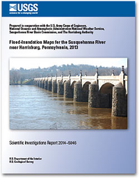
Flood-inundation maps for the Susquehanna River near Harrisburg, Pennsylvania, 2013
Links
- More information: USGS Index Page
- Document: Report
- Download citation as: RIS | Dublin Core
Abstract
A series of 28 digital flood-inundation maps was developed for an approximate 25-mile reach of the Susquehanna River in the vicinity of Harrisburg, Pennsylvania. The study was selected by the U.S. Army Corps of Engineers (USACE) national Silver Jackets program, which supports interagency teams at the state level to coordinate and collaborate on flood-risk management. This study to produce flood-inundation maps was the result of a collaborative effort between the USACE, National Weather Service (NWS), Susquehanna River Basin Commission (SRBC), The Harrisburg Authority, and the U.S. Geological Survey (USGS). These maps are accessible through Web-mapping applications associated with the NWS, SRBC, and USGS. The maps can be used in conjunction with the real-time stage data from the USGS streamgage 01570500, Susquehanna River at Harrisburg, Pa., and NWS flood-stage forecasts to help guide the general public in taking individual safety precautions and will provide local municipal officials with a tool to efficiently manage emergency flood operations and flood mitigation efforts.
The maps were developed using the USACE HEC–RAS and HEC–GeoRAS programs to compute water-surface profiles and to delineate estimated flood-inundation areas for selected stream stages. The maps show estimated flood-inundation areas overlaid on high-resolution, georeferenced, aerial photographs of the study area for stream stages at 1-foot intervals between 11 feet and 37 feet (which include NWS flood categories Action, Flood, Moderate, and Major) and the June 24, 1972, peak-of-record flood event at a stage of 33.27 feet at the Susquehanna River at Harrisburg, Pa., streamgage.
Suggested Citation
Roland, M.A., Underwood, S.M., Thomas, C.M., Miller, J.F., Pratt, B.A., Hogan, L.G., Wnek, P.A., 2014, Flood-inundation maps for the Susquehanna River near Harrisburg, Pennsylvania, 2013: U.S. Geological Survey Scientific Investigations Report 2014-5046, vi, 17 p., https://doi.org/10.3133/sir20145046.
ISSN: 2328-0328 (online)
Study Area
| Publication type | Report |
|---|---|
| Publication Subtype | USGS Numbered Series |
| Title | Flood-inundation maps for the Susquehanna River near Harrisburg, Pennsylvania, 2013 |
| Series title | Scientific Investigations Report |
| Series number | 2014-5046 |
| DOI | 10.3133/sir20145046 |
| Year Published | 2014 |
| Language | English |
| Publisher | U.S. Geological Survey |
| Publisher location | Reston, VA |
| Contributing office(s) | Pennsylvania Water Science Center |
| Description | vi, 17 p. |
| Country | United States |
| State | Pennsylvania |
| City | Harrisburg |
| Other Geospatial | Susquehanna River |
| Online Only (Y/N) | Y |


