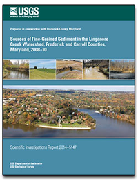
Sources of fine-grained sediment in the Linganore Creek watershed, Frederick and Carroll Counties, Maryland, 2008-10
Links
- More information: USGS Index Page
- Document: Report (3.88 MB pdf)
- Appendix: Appendix 1-13 (295 KB xlsx)
- Download citation as: RIS | Dublin Core
Abstract
Sediment fingerprinting quantifies the delivery of fine-grained sediment from a watershed and sediment-budget measurements quantify the erosion and deposition of fine-grained sediment. Both approaches were used in the agricultural and forested 147-square-kilometer (km2) Linganore Creek watershed in Maryland from August 1, 2008 through December 31, 2010, to determine the sources of fine-grained (less than 63 microns) sediment, and the amount of fine-grained sediment eroded from and deposited on streambanks, flood plains, channel beds, and agricultural and forested uplands. Sediment-weighted results of sediment fingerprinting for 194 suspended-sediment samples collected during 36 storms indicate that streambanks contributed 52 percent of the annual fine-grained suspended-sediment load, agriculture (cropland and pasture) contributed 45 percent, and forests contributed 3 percent. Fifty-four percent of the Linganore Creek watershed is agriculture and 27 percent is forest.
Sediment-budget calculations were based on field measurements and photogrammetric analyses and indicated that the highest percentage of fine-grained sediment was eroded from agriculture (86 percent), followed by streambanks (10 percent), forests (3 percent), and the channel bed (less than 1 percent). Results of the sediment budget indicated that the highest percentage of fine-grained sediment was stored in ponds (57 percent), followed by flood plains (32 percent), streambanks (6 percent), and the channel bed (5 percent). Typical of most sediment budgets, the final sediment budget indicated erosion of 4.70 x 10⁷kilograms per year (kg/yr), which is higher than the fine-grained suspended-sediment load leaving the watershed (5.45 x 10⁶kg/yr). The differences in the sediment budget and the measured mass leaving the watershed could be due to an overestimation of erosion using the Cesium-137 method and (or) not adequately defining and measuring storage areas.
Management implications of this study indicate that both agriculture and streambanks are important sources of sediment in Linganore Creek where the delivery of agriculture sediment was 4 percent and the delivery of streambank sediment was 44 percent. Fourth order streambanks, on average, had the highest rates of bank erosion. Combining the sediment fingerprinting and sediment budget results indicates that 96 percent of the eroded fine-grained sediment from agriculture went into storage. Flood plains and ponds are effective storage sites of sediment in the Linganore Creek watershed. Flood plains stored 8 percent of all eroded sediment with 4th and 5th order flood plains, on average, storing the most sediment. Small ponds in the Linganore Creek watershed, which drained 16 percent of the total watershed area, stored 15 percent of all eroded sediment. Channel beds were relatively stable with the greatest erosion generally occurring in 4th and 5th order streams.
Suggested Citation
Gellis, A., Noe, G., Clune, J.W., Myers, M., Hupp, C.R., Schenk, E.R., Schwarz, G., 2015, Sources of fine-grained sediment in the Linganore Creek watershed, Frederick and Carroll Counties, Maryland, 2008-10: U.S. Geological Survey Scientific Investigations Report 2014-5147, Report: vii, 56 p.; Appendix, https://doi.org/10.3133/sir20145147.
ISSN: 2328-0328 (online)
Study Area
| Publication type | Report |
|---|---|
| Publication Subtype | USGS Numbered Series |
| Title | Sources of fine-grained sediment in the Linganore Creek watershed, Frederick and Carroll Counties, Maryland, 2008-10 |
| Series title | Scientific Investigations Report |
| Series number | 2014-5147 |
| DOI | 10.3133/sir20145147 |
| Year Published | 2015 |
| Language | English |
| Publisher | U.S. Geological Survey |
| Publisher location | Reston, VA |
| Contributing office(s) | Maryland Water Science Center |
| Description | Report: vii, 56 p.; Appendix |
| Time Range Start | 2008-01-01 |
| Time Range End | 2010-12-31 |
| Country | United States |
| State | Maryland |
| County | Carroll County, Frederick County |
| Other Geospatial | Linganore Creek Watershed |
| Datum | North American Datum of 1983 |
| Online Only (Y/N) | Y |
| Additional Online Files (Y/N) | Y |


