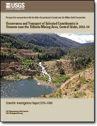
Occurrence and transport of selected constituents in streams near the Stibnite mining area, Central Idaho, 2012–14
Links
- Document: Report (4.3 MB pdf)
- Appendix: Appendix B (40 KB xlsx)
- Download citation as: RIS | Dublin Core
Abstract
Mining of stibnite (antimony sulfide), tungsten, gold, silver, and mercury near the town of Stibnite in central Idaho has left a legacy of trace element contamination in local streams. Water-quality and streamflow monitoring data from a network of five streamflow-gaging stations were used to estimate trace-element and suspended-sediment loads and flow-weighted concentrations in the Stibnite mining area between 2012 and 2014. Measured concentrations of arsenic exceeded human health-based water-quality criteria at each streamflow-gaging station, except for Meadow Creek (site 2), which was selected to represent background conditions in the study area. Measured concentrations of antimony exceeded human health-based water-quality criteria at sites 3, 4, and 5.
Regression models developed using the U.S. Geological Survey LOAD ESTimation (LOADEST) program showed that concentrated sources of arsenic and antimony are present in specific reaches along Meadow Creek and the East Fork of South Fork of the Salmon River (EFSFSR) between the EFSFSR at Stibnite (site 3) and the EFSFSR above Sugar Creek (site 4). Eighty percent of the arsenic and antimony loads were attributable to discrete reaches that accounted for 25 percent of the total streamflow in the study area. Streamflow was negatively correlated with arsenic and antimony concentrations, indicating groundwater sources. Continuously monitored specific conductance, alone or combined with continuously computed streamflow, was more significant than streamflow alone as a surrogate measure of dissolved arsenic and antimony concentrations. Surrogate regression models (with coefficients of determination ranging from 0.96 to 0.65) can be used to estimate arsenic and antimony concentrations in real time at all five streamflow-gaging stations.
LOADEST model simulation results indicated hysteresis in transport of suspended sediment and sediment-associated constituents. Predictor variables that account for streamflow variability reduced model bias and root mean square error when included in regression models used to estimate concentrations and loads of suspended sediment, total aluminum, total lead, and total mercury.
Ninety-eight percent of the estimated total mercury load transported downstream of the study area is attributable to Sugar Creek. A maximum concentration of 26 micrograms per liter was measured in Sugar Creek during May 2013 when snowmelt runoff occurred during a single peak in the hydrograph. Monitoring and modeling results indicate sediment and sediment-associated constituent concentrations and loads increase along Meadow Creek, likely because of the inflow of the East Fork of Meadow Creek, and decrease between sites 3 and 4 because the Glory Hole is trapping sediments. Sugar Creek (site 5) accounted for most of the sediment and sediment-associated constituent loading leaving the study area because loads from the East Fork of Meadow Creek remained trapped in the Glory Hole. Additionally, total mercury was detected at all five streamflow-gaging stations, and sampled mercury concentrations exceeded Idaho ambient water-quality criteria at all five streamflow-gaging stations.
Suggested Citation
Etheridge, A.B., 2015, Occurrence and transport of selected constituents in streams near the Stibnite mining area, central Idaho, 2012–14: U.S. Geological Survey Scientific Investigations Report 2015–5166, 47 p., https://dx.doi.org/10.3133/sir20155166.
ISSN: 2328-0328 (online)
Study Area
Table of Contents
- Abstract
- Introduction
- Description of Study Area
- Study Methods
- Streamflow and Water-Quality Monitoring
- Occurrence, Transport, and Deposition of Selected Constituents
- LOAD ESTimation (LOADEST) Model Results
- Surrogate Regression Modeling of Constituent Concentrations
- Areas of Further Study
- Summary
- Acknowledgments
- References Cited
- Appendix A–B
| Publication type | Report |
|---|---|
| Publication Subtype | USGS Numbered Series |
| Title | Occurrence and transport of selected constituents in streams near the Stibnite mining area, Central Idaho, 2012–14 |
| Series title | Scientific Investigations Report |
| Series number | 2015-5166 |
| DOI | 10.3133/sir20155166 |
| Publication Date | December 07, 2015 |
| Year Published | 2015 |
| Language | English |
| Publisher | U.S. Geological Survey |
| Publisher location | Reston, VA |
| Contributing office(s) | Idaho Water Science Center |
| Description | Report: vii, 47 p.; Appendix B |
| Time Range Start | 2011-10-01 |
| Time Range End | 2014-09-30 |
| Country | United States |
| State | Idaho |
| Other Geospatial | Stibnite Mining Area |
| Online Only (Y/N) | Y |
| Additional Online Files (Y/N) | Y |


