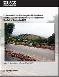
Estimates of peak flood discharge for 21 sites in the Front Range in Colorado in response to extreme rainfall in September 2013
Links
- Document: Report (14.0 MB pdf)
- Download citation as: RIS | Dublin Core
Abstract
Extreme rainfall in September 2013 caused destructive floods in part of the Front Range in Boulder County, Colorado. Erosion from these floods cut roads and isolated mountain communities for several weeks, and large volumes of eroded sediment were deposited downstream, which caused further damage of property and infrastructures. Estimates of peak discharge for these floods and the associated rainfall characteristics will aid land and emergency managers in the future. Several methods (an ensemble) were used to estimate peak discharge at 21 measurement sites, and the ensemble average and standard deviation provided a final estimate of peak discharge and its uncertainty. Because of the substantial erosion and deposition of sediment, an additional estimate of peak discharge was made based on the flow resistance caused by sediment transport effects.
Although the synoptic-scale rainfall was extreme (annual exceedance probability greater than 1,000 years, about 450 millimeters in 7 days) for these mountains, the resulting peak discharges were not. Ensemble average peak discharges per unit drainage area (unit peak discharge, [Qu]) for the floods were 1–2 orders of magnitude less than those for the maximum worldwide floods with similar drainage areas and had a wide range of values (0.21–16.2 cubic meters per second per square kilometer [m3 s-1 km-2]). One possible explanation for these differences was that the band of high-accumulation, high-intensity rainfall was narrow (about 50 kilometers wide), oriented nearly perpendicular to the predominant drainage pattern of the mountains, and therefore entire drainage areas were not subjected to the same range of extreme rainfall. A linear relation (coefficient of determination [R2]=0.69) between Qu and the rainfall intensity (ITc, computed for a time interval equal to the time-of-concentration for the drainage area upstream from each site), had the form: Qu=0.26(ITc-8.6), where the coefficient 0.26 can be considered to be an area-averaged peak runoff coefficient for the September 2013 rain storms in Boulder County, and the 8.6 millimeters per hour to be the rainfall intensity corresponding to a soil moisture threshold that controls the soil infiltration rate. Peak discharge estimates based on the sediment transport effects were generally less than the ensemble average and indicated that sediment transport may be a mechanism that limits velocities in these types of mountain streams such that the Froude number fluctuates about 1 suggesting that this type of floodflow can be approximated as critical flow.
Suggested Citation
Moody, J.A., 2016, Estimates of peak flood discharge for 21 sites in the Front Range in Colorado in response to extreme rainfall in September 2013: U.S. Geological Survey Scientific Investigations Report 2016–5003, 64 p., https://dx.doi.org/10.3133/sir20165003.
ISSN: 2328-0328 (online)
Study Area
Table of Contents
- Abstract
- Introduction
- Field Methods
- Indirect Discharge Calculations
- Rainfall Intensity Calculations
- Estimates of Peak Discharge
- Discussion
- Summary
- Acknowledgments
- References Cited
| Publication type | Report |
|---|---|
| Publication Subtype | USGS Numbered Series |
| Title | Estimates of peak flood discharge for 21 sites in the Front Range in Colorado in response to extreme rainfall in September 2013 |
| Series title | Scientific Investigations Report |
| Series number | 2016-5003 |
| DOI | 10.3133/sir20165003 |
| Publication Date | March 21, 2016 |
| Year Published | 2016 |
| Language | English |
| Publisher | U.S. Geological Survey |
| Publisher location | Reston, VA |
| Contributing office(s) | National Research Program - Central Branch |
| Description | vi, 65p. |
| Country | United States |
| State | Colorado |
| Online Only (Y/N) | Y |
| Additional Online Files (Y/N) | N |


