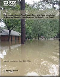
Characterization of peak streamflows and flood inundation of selected areas in Louisiana from the August 2016 flood
Links
- Document: Report (7.98 MB pdf)
- Data Release: USGS Data Release - Flood Inundation Extent and Depth in Selected Areas of Louisiana in August 2016
- Download citation as: RIS | Dublin Core
Abstract
Heavy rainfall occurred across Louisiana and southwestern Mississippi in August 2016 as a result of a slow-moving area of low pressure and a high amount of atmospheric moisture. The storm caused major flooding in the southern portions of Louisiana including areas surrounding Baton Rouge and Lafayette. Flooding occurred along the rivers such as the Amite, Comite, Tangipahoa, Tickfaw, Vermilion, and Mermentau Rivers. Over 31 inches of rain was reported in the city of Watson, 20 miles northeast of Baton Rouge, La., over the duration of the event. Streamflow-gaging stations operated by the U.S. Geological Survey (USGS) recorded peak streamflows of record at 10 locations, and 7 other locations experienced peak streamflows ranking in the top five for the duration of the period of record. In August 2016, USGS hydrographers made 50 discharge measurements at 21 locations on streams in Louisiana. Many of those discharge measurements were made for the purpose of verifying the accuracy of stage-streamflow relations at gaging stations operated by the USGS. Following the storm event, USGS hydrographers recovered and documented 590 high-water marks, noting location and height of the water above land surface. Many of these high-water marks were used to create 12 flood-inundation maps for selected communities of Louisiana that experienced flooding in August 2016. Digital datasets of the inundation area, modeling boundary, water depth rasters, and final map products are available online.
Suggested Citation
Watson, K.M., Storm, J.B., Breaker, B.K., and Rose, C.E., 2017, Characterization of peak streamflows and flood inundation of selected areas in Louisiana from the August 2016 flood: U.S. Geological Survey Scientific Investigations Report 2017–5005, 26 p., https://doi.org/10.3133/sir20175005.
ISSN: 2328-0328 (online)
Study Area
Table of Contents
- Abstract
- Introduction
- Weather Conditions Prior to and During the Flood
- Methods
- Estimated Magnitudes and Flood Probabilities of Peak Streamflows
- Flood-Inundation Maps
- Flood Damages
- Summary
- Selected References
| Publication type | Report |
|---|---|
| Publication Subtype | USGS Numbered Series |
| Title | Characterization of peak streamflows and flood inundation of selected areas in Louisiana from the August 2016 flood |
| Series title | Scientific Investigations Report |
| Series number | 2017-5005 |
| DOI | 10.3133/sir20175005 |
| Publication Date | February 06, 2017 |
| Year Published | 2017 |
| Language | English |
| Publisher | U.S. Geological Survey |
| Publisher location | Reston, VA |
| Contributing office(s) | Lower Mississippi-Gulf Water Science Center |
| Description | Report: v, 26 p.; Data Release |
| Country | United States |
| State | Louisiana |
| Online Only (Y/N) | Y |
| Additional Online Files (Y/N) | Y |


