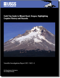
Field-trip guide to Mount Hood, Oregon, highlighting eruptive history and hazards
Links
- Document: Report (27 MB pdf)
- Larger Work: This publication is Chapter G of Field-trip guides to selected volcanoes and volcanic landscapes of the western United States
- Download citation as: RIS | Dublin Core
Abstract
This guidebook describes stops of interest for a geological field trip around Mount Hood volcano. It was developed for the 2017 International Association of Volcanology and Chemistry of the Earth’s Interior (IAVCEI) Scientific Assembly in Portland, Oregon. The intent of this guidebook and accompanying contributions is to provide an overview of Mount Hood, including its chief geologic processes, magmatic system, eruptive history, local tectonics, and hazards, by visiting a variety of readily accessible localities. We also describe coeval, largely monogenetic, volcanoes in the region. Accompanying the field-trip guidebook are separately authored contributions that discuss in detail the Mount Hood magmatic system and its products and behavior (Kent and Koleszar, this volume); Mount Hood earthquakes and their relation to regional tectonics and the volcanic system (Thelen and Moran, this volume); and young surface faults cutting the broader Mount Hood area whose extent has come to light after acquisition of regional light detection and ranging coverage (Madin and others, this volume).
The trip makes an approximately 175-mile (280-kilometer) clockwise loop around Mount Hood, starting and ending in Portland. The route heads east on Interstate 84 through the Columbia River Gorge National Scenic Area. The guidebook points out only a few conspicuous features of note in the gorge, but many other guides to the gorge are available. The route continues south on the Mount Hood National Scenic Byway on Oregon Route 35 following Hood River, and returns to Portland on U.S. Highway 26 following Sandy River. The route traverses rocks as old as the early Miocene Eagle Creek Formation and overlying Columbia River Basalt Group of middle Miocene age, but chiefly lava flows and clastic products of arc volcanism of late Miocene to Holocene age.
Suggested Citation
Scott, W.E., and Gardner, C.A., 2017, Field-trip guide to Mount Hood, Oregon, highlighting eruptive history and hazards: U.S. Geological Survey Scientific Investigations Report 2017–5022–G, 115 p., https://doi.org/10.3133/sir20175022g.
ISSN: 2328-0328 (online)
Study Area
Table of Contents
- Introduction
- Highlights of Quaternary Volcanism
- Route From Portland to Hood River
- Field-Trip Stops
- Stop 1. Panorama Point Overlook of the Cascade Range, Mount Hood, and Hood River Valley
- Stop 2. Hood River Lahar
- Stop 3. Andesite of Parkdale
- Stop 4. Quarry in Lower Pleistocene Basalt of Tilly Jane; View of North Flank of Mount Hood
- Stop 5. Basaltic Andesite and Andesite of Cloud Cap and Basaltic Andesite of Dog River
- Stop 6. Quarry in Lava Flow of Cloud Cap Volcano
- Stop 7. View Up Eliot Branch From Inspiration Point
- Stop 8. Cloud Cap Inn
- Stop 9. Pre-Hood Andesite of Doe Creek
- 1980 Debris Flow and Flood on Polallie Creek
- Stop 10. Late Pleistocene Andesite Lava Flow of Tamanawas Falls, Part of Langille Crags-Texas Eruptive Episode of High-strontium Lava
- Mafic Enclaves in Mount Hood Andesite
- Stop 11. Pocket Creek—LGM End Moraines Rich in Dome Lava and View of Southeast Flank of Mount Hood
- Stop 12. Bennett Pass Till Exposure
- Stop 13. Main Parking Lot at Mount Hood Meadows Ski Resort
- Stop 14. White River Pyroclastic-Flow and Lahar Deposits of Old Maid Age
- Stop 15. Frog Lake Fault Scarps
- Stop 16. U.S. Highway 26 Roadcuts in Andesite of South Flank
- Stop 17. Three Stops Along Timberline Road
- Timberline Lodge Area
- Stop 18. Hike East from Timberline Lodge on Timberline Trail to Rim of White River Canyon and Additional Sites
- Stop 19. Hike Timberline Trail West from Timberline Lodge to Little Zigzag and Zigzag Canyons
- Stop 20. Andesite of Yocum Falls
- Stop 21. Quarry in Basaltic Andesite and Andesite of Little Zigzag River; Timberline Deposits and Contact Between Timberline and Polallie Deposits
- Stop 22. Andesite of Lower Zigzag Canyon and Andesite of Lady Creek
- Stop 23. Late Holocene Lahar Deposits Along Upper Sandy River
- Stop 24. West Flank of Mount Hood and Sandy Glacier Volcano
- Stop 25. Basalt of Bald Mountain, and View of West Flank of Mount Hood and Sandy Glacier Volcano
- Stop 26. Jonsrud Viewpoint Park
- Stop 27. Lahar and Lahar-Runout Deposits of Timberline Age on West Bank of Sandy River
- Mount Hood Volcano Hazards
- References Cited
Sections
- A Summary of Recent Petrological and Geochemical Studies of Mount Hood, Oregon
- The Mount Hood Fault Zone—Late Quaternary and Holocene Fault Features Newly Mapped with High-resolution Lidar Imagery
- Seismicity At and Around Mount Hood, Oregon
| Publication type | Report |
|---|---|
| Publication Subtype | USGS Numbered Series |
| Title | Field-trip guide to Mount Hood, Oregon, highlighting eruptive history and hazards |
| Series title | Scientific Investigations Report |
| Series number | 2017-5022 |
| Chapter | G |
| DOI | 10.3133/sir20175022G |
| Publication Date | June 22, 2017 |
| Year Published | 2017 |
| Language | English |
| Publisher | U.S. Geological Survey |
| Publisher location | Reston, VA |
| Contributing office(s) | Volcano Science Center |
| Description | xii, 115 p. |
| Country | United States |
| State | Oregon |
| Other Geospatial | Mount Hood |


