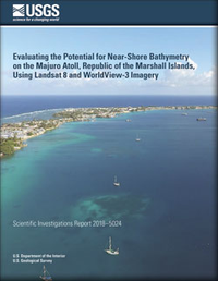
Evaluating the potential for near-shore bathymetry on the Majuro Atoll, Republic of the Marshall Islands, using Landsat 8 and WorldView-3 imagery
Links
- Document: Report (3.28 MB pdf)
- Data Release: USGS data release - One Meter Topobathymetric Digital Elevation Model for Majuro Atoll, Republic of the Marshall Islands, 1944 to 2016
- Download citation as: RIS | Dublin Core
Abstract
Satellite-derived near-shore bathymetry (SDB) is becoming an increasingly important method for assessing vulnerability to climate change and natural hazards in low-lying atolls of the northern tropical Pacific Ocean. Satellite imagery has become a cost-effective means for mapping near-shore bathymetry because ships cannot collect soundings safely while operating close to the shore. Also, green laser light detection and ranging (lidar) acquisitions are expensive in remote locations. Previous research has demonstrated that spectral band ratio-based techniques, commonly called the natural logarithm approach, may lead to more precise measurements and modeling of bathymetry because of the phenomenon that different substrates at the same depth have approximately equal ratio values. The goal of this research was to apply the band ratio technique to Landsat 8 at-sensor radiance imagery and WorldView-3 atmospherically corrected imagery in the coastal waters surrounding the Majuro Atoll, Republic of the Marshall Islands, to derive near-shore bathymetry that could be incorporated into a seamless topobathymetric digital elevation model of Majuro. Attenuation of light within the water column was characterized by measuring at-sensor radiance and reflectance at different depths and calculating an attenuation coefficient. Bathymetric lidar data, collected by the U.S. Naval Oceanographic Office in 2006, were used to calibrate the SDB results. The bathymetric lidar yielded a strong linear relation with water depths. The Landsat 8-derived SDB estimates derived from the blue/green band ratio exhibited a water attenuation extinction depth of 6 meters with a coefficient of determination R2=0.9324. Estimates derived from the coastal/red band ratio had an R2=0.9597. At the same extinction depth, SDB estimates derived from WorldView-3 imagery exhibited an R2=0.9574. Because highly dynamic coastal shorelines can be affected by erosion, wetland loss, hurricanes, sea-level rise, urban development, and population growth, consistent bathymetric data are needed to better understand sensitive coastal land/water interfaces in areas subject to coastal disasters.
Suggested Citation
Poppenga, S.K., Palaseanu-Lovejoy, M., Gesch, D.B., Danielson, J.J., and Tyler, D.J., 2018, Evaluating the potential for near-shore bathymetry on the Majuro Atoll, Republic of the Marshall Islands, using Landsat 8 and WorldView-3 imagery: U.S. Geological Survey Scientific Investigations Report 2018–5024, 14 p., https://doi.org/10.3133/sir20185024.
ISSN: 2328-0328 (online)
Table of Contents
- Acknowledgments
- Abstract
- Introduction
- Background
- Data Used for Satellite-Derived Bathymetry
- Methods
- Results
- Discussion
- Conclusion
- References Cited
| Publication type | Report |
|---|---|
| Publication Subtype | USGS Numbered Series |
| Title | Evaluating the potential for near-shore bathymetry on the Majuro Atoll, Republic of the Marshall Islands, using Landsat 8 and WorldView-3 imagery |
| Series title | Scientific Investigations Report |
| Series number | 2018-5024 |
| DOI | 10.3133/sir20185024 |
| Publication Date | April 16, 2018 |
| Year Published | 2018 |
| Language | English |
| Publisher | U.S. Geological Survey |
| Publisher location | Reston, VA |
| Contributing office(s) | Earth Resources Observation and Science (EROS) Center |
| Description | Report: vii, 14 p.; Data Release |
| Country | Republic of the Marshall Islands |
| Other Geospatial | Majuro Atoll |
| Online Only (Y/N) | Y |
| Additional Online Files (Y/N) | Y |


