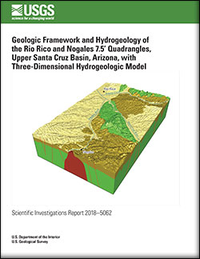
Geologic framework and hydrogeology of the Rio Rico and Nogales 7.5’ quadrangles, upper Santa Cruz Basin, Arizona, with three-dimensional hydrogeologic model
Links
- Document: Report (23.0 MB pdf)
- Data Release: USGS data release - Data Release for Geologic Framework and Hydrogeology of the Rico Rico and Nogales 7.5' quadrangles, Upper Santa Cruz basin, Arizona, with 3-Dimensional hydrogeologic model
- Download citation as: RIS | Dublin Core
Abstract
Rapid population growth and declining annual recharge to aquifers in the upper Santa Cruz Basin area of southern Arizona, have increased the demand for additional groundwater resources. This demand is predicted to escalate in the future because of higher temperatures, longer droughts, less aquifer recharge, and decreased river and stream base flow. We conducted geologic studies to help evaluate and better understand groundwater resources in the basin. Results of these studies are presented in this report, which summarizes the basin geologic framework and hydrogeology, and presents a threedimensional (3D) hydrogeologic model for the Rio Rico and Nogales 7.5′ quadrangles. Three major hydrogeologic units are displayed in the 3D model; a lower basement confining unit, consisting of Jurassic, Cretaceous, and Tertiary (Paleocene and Oligocene) rocks; a middle unit composed entirely of the Miocene Nogales Formation; and an upper unit consisting of late Miocene to Holocene surficial deposits. The Nogales Formation and the late Miocene to Holocene sediments are the main aquifers in the upper Santa Cruz Basin. The 3D model integrates the hydrogeologic units and faults to define the geometry, structure, and thickness of the aquifer system that provides water to Nogales and surrounding communities of southernmost Arizona. The report includes an EarthVision 3D Viewer, consisting of software enabling the user to view data interactively in 3D space to help explain the internal complexities of the basin geometry, structure, stratigraphy, and hydrology. The 3D model is a synthesis of geologic data from geologic maps, cross sections, and lithologic descriptions and interpretations; and geophysical data including gravity, magnetic data, and airborne electromagnetic data.
Suggested Citation
Page, W.R., Bultman, M.W., VanSistine, D.P., Menges, C.M., Gray, Floyd, and Pantea, M.P., 2018, Geologic framework and hydrogeology of the Rio Rico and Nogales 7.5’ quadrangles, upper Santa Cruz Basin, Arizona, with three-dimensional hydrogeologic model: U.S. Geological Survey Scientific Investigations Report 2018–5062, 34 p., https://doi.org/10.3133/sir20185062.
ISSN: 2328-0328 (online)
Study Area
Table of Contents
- Abstract
- Introduction
- Geologic Framework
- Basin Structure
- Miocene to Holocene Development of the Upper Santa Cruz Basin in the Study Area
- Data for Construction of the Three-Dimensional Hydrogeologic Model
- Model Construction Methodology
- Conclusions
- References Cited
| Publication type | Report |
|---|---|
| Publication Subtype | USGS Numbered Series |
| Title | Geologic framework and hydrogeology of the Rio Rico and Nogales 7.5’ quadrangles, upper Santa Cruz Basin, Arizona, with three-dimensional hydrogeologic model |
| Series title | Scientific Investigations Report |
| Series number | 2018-5062 |
| DOI | 10.3133/sir20185062 |
| Publication Date | August 08, 2018 |
| Year Published | 2018 |
| Language | English |
| Publisher | U.S. Geological Survey |
| Publisher location | Reston, VA |
| Contributing office(s) | Geosciences and Environmental Change Science Center |
| Description | Report: vi, 34 p.; Data release |
| Country | United States |
| State | Arizona |
| Other Geospatial | Rio Rico and Nogales 7.5’ Quadrangles, Upper Santa Cruz Basin |
| Online Only (Y/N) | Y |


