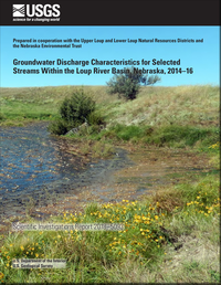
Groundwater discharge characteristics for selected streams within the Loup River Basin, Nebraska, 2014–16
Links
- Document: Report (20.5 MB pdf)
- Data Release: USGS data release - Aerial thermal infrared imagery, focused groundwater discharge points, water temperature, streambed temperature, and vertical hydraulic gradient data collected along the South Loup, Dismal, and North Loup Rivers, Nebraska, 2014–16
- Download citation as: RIS | Dublin Core
Abstract
Streams in the Loup River Basin are sensitive to groundwater withdrawals because of the close hydrologic connection between groundwater and surface water. Groundwater discharge is the primary component of streamflow in the Loup River Basin and constitutes more than 90 percent of streamflow in the central part of the Sand Hills. To improve the understanding of geologic controls and various climatic and land-use changes on groundwater discharge, the U.S. Geological Survey (USGS), in cooperation with the Upper Loup Natural Resources District (NRD), the Lower Loup NRD, and the Nebraska Environmental Trust, studied the spatial and temporal characteristics of groundwater discharge within the Loup River Basin. This report documents the methods of data collection and analysis, which include the collection of approximately 350 river miles of aerial thermal infrared imagery and continuous groundwater-level and temperature data from six streamflow-gaging stations within the Loup River Basin.
The results from the stream reconnaissance and examination of aerial thermal infrared imagery demonstrated the influence of the surficial and subsurface geology on the spatial characteristics of groundwater discharge to streams in the Loup River Basin. At the headwaters of the South Loup River, streamflow is sustained and increased from focused groundwater discharge emanating from Quaternary deposits at many small (less than 0.1 cubic foot per second) focused points. The volume of water produced from this dense network of focused groundwater discharge points along the North Fork South Loup River is sufficient to provide approximately 40 percent of the flow measured at the South Loup River at Arnold, Nebraska streamflow-gaging station (USGS station 06781600) during the irrigation season. Approximately 5 miles downstream from the South Loup River at Arnold, Nebr., streamflow-gaging station, the river incises into Pliocene-age sand and gravel deposits, which provide additional groundwater discharge to the stream. The streamflow of the South Loup River increases by a factor of 5 across a 62-mile reach of the middle South Loup River.
Increases in streamflow along the upper Dismal River result from a dense network of focused groundwater discharge points within semiconsolidated Pliocene-age deposits. Below the Dismal River near Thedford, Nebr., streamflow-gaging station (USGS station 06775900), the Dismal River incises into the Ogallala Formation over a short reach before flowing over coarser, more permeable Quaternary-age alluvial deposits. Diffuse groundwater discharge sustains and increases the streamflow of the lower Dismal River in this reach.
Groundwater sapping was evident on some stream reaches and has increased the size and flow of focused groundwater discharge points. Previous researchers have documented streambed incision and groundwater sapping on the upper Dismal River that have created and enlarged focused groundwater discharge points capturing additional groundwater. Similar processes appear to have played a role in the formation of larger focused groundwater discharge points, which sustain the flow of the middle South Loup River. The constant flow of groundwater into the South Loup River has removed finer-grained Quaternary sediments and further exposed Pliocene-age gravel deposits. Headward erosion is evident where some of the large focused groundwater discharge points have incised their own draws and terminate in bowl-like depressions away from the stream.
Within the Loup River NRDs, the percentage of groundwater-irrigated land in a stream basin is one factor that affects groundwater discharge to streams. A striking example was at the South Loup River at Saint Michael, Nebr., groundwater and streamflow-gaging station (USGS station 06784000) where the shallow groundwater levels declined below the level of the stream during the middle to late part of the growing season (July to September) when consumptive groundwater use was at its peak. The South Loup River Basin above the South Loup River at Saint Michael, Nebr., streamflow-gaging station has the highest percentage of groundwater-irrigated row crops of all the basins examined in this study. Continuous groundwater and surface-water levels measured at the North Loup River at the Taylor, Nebr., streamflow-gaging station (USGS station 06786000) indicate that the stream is receiving groundwater throughout the year; however, when consumptive groundwater use peaks during the middle to late part of the growing season (July to September), the difference in elevation between the groundwater level and the stream elevation decreases, which indicates a reduction in the amount of groundwater discharge received.
Suggested Citation
Hobza, C.M., and Schepers, A.R., 2018, Groundwater discharge characteristics for selected streams within the Loup River Basin, Nebraska, 2014–16: U.S. Geological Survey Scientific Investigations Report 2018–5093, 50 p., https://doi.org/10.3133/sir20185093.
ISSN: 2328-0328 (online)
Study Area
Table of Contents
- Acknowledgments
- Abstract
- Introduction
- Approach and Methods
- Groundwater Discharge Characteristics for Streams in the Loup River Basin
- Primary Controls on Groundwater Discharge Characteristics Within the Loup River Basin
- Summary
- References Cited
| Publication type | Report |
|---|---|
| Publication Subtype | USGS Numbered Series |
| Title | Groundwater discharge characteristics for selected streams within the Loup River Basin, Nebraska, 2014–16 |
| Series title | Scientific Investigations Report |
| Series number | 2018-5093 |
| DOI | 10.3133/sir20185093 |
| Publication Date | July 24, 2018 |
| Year Published | 2018 |
| Language | English |
| Publisher | U.S. Geological Survey |
| Publisher location | Reston, VA |
| Contributing office(s) | Nebraska Water Science Center |
| Description | Report: vi, 50 p.; Data Release |
| Country | United States |
| State | Nebraska |
| Other Geospatial | Loup River Basin |
| Online Only (Y/N) | Y |
| Additional Online Files (Y/N) | Y |


