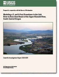
Modeling a 2- and 4-Foot Drawdown in the Link River to Keno Dam Reach of the Upper Klamath River, South-Central Oregon
Links
- Document: Report (4.5 MB pdf)
- NGMDB Index Page: National Geologic Map Database Index Page
- Download citation as: RIS | Dublin Core
Executive Summary
The most upstream, pooled reach of the Klamath River in south-central Oregon, from Link River mouth to Keno Dam (Link-Keno), has a water-surface elevation that remains relatively constant throughout the year. Two model scenarios, using an existing two-dimensional hydrodynamic and water-quality model (CE-QUAL-W2), were constructed to examine the effects of lowering the water-surface elevation by 2 and 4 feet (ft) (0.61 and 1.2 meters) throughout an entire calendar year to mimic some of the potential effects of removal or modification of Keno Dam. Model results for these drawdown scenarios were analyzed for changes in velocity, travel time, water temperature, total dissolved solids, inorganic suspended sediment, nutrients, organic matter, chlorophyll a, and dissolved oxygen, compared to the base-case model. The model used in this study had been previously calibrated with the presence of aquatic plants (macrophytes). However, most model analyses were completed for model runs where macrophytes were “turned off” because the species, abundance, and distribution of macrophytes in a lowered-water scenario were all highly uncertain. For comparison, a few model scenario runs were completed with macrophytes enabled within the model. Findings from this study include the following:
- Modeled water velocity increased and travel time decreased substantially throughout the reach with the 2- and 4-ft drawdown scenarios, with travel time roughly halved in the 4-ft scenario under unchanged flow conditions.
- For many water-quality constituents in the drawdown scenarios, the model showed little to no change in outflow concentrations at Keno Dam compared to the base case, which represents conditions based on year 2007 water-level elevations. However, chlorophyll a and particulate organic carbon concentrations increased in the Keno Dam outflow in summer with the drawdowns. This seemed to be related to the increased water velocity. As suspended algae and other particulate organic matter such as dead algal cells and detritus moved farther downstream with the faster velocity, there was relatively less deposition of that material in the most upstream model segments and relatively more deposition in downstream segments of the Link-Keno reach, especially in summer and autumn, the period with the largest algae bloom.
- Despite minor differences in the Keno Dam outflow, modeled dissolved oxygen concentration and water temperature showed some changes in the Link-Keno reach compared to the base case, with differences as large as 2 milligrams per liter and 2 degrees Celsius, respectively, computed as segment averages and daily averages.
- With macrophytes enabled, the model outflow in the drawdown scenarios showed a decrease in dissolved oxygen concentration in mid-summer that seemed to be related to decreased macrophyte abundance and primary production in those scenarios. The with-macrophyte model results have greater uncertainty, but the results indicated that macrophytes are likely to be an important factor in the dissolved oxygen budget under reduced water-surface elevations.
Suggested Citation
Sullivan, A.B., and Rounds, S.A., 2020, Modeling a 2- and 4-foot drawdown in the Link River to Keno Dam reach of the upper Klamath River, south-central Oregon: U.S. Geological Survey Scientific Investigations Report 2020–5001, 18 p., https://doi.org/10.3133/sir20205001.
ISSN: 2328-0328 (online)
Study Area
Table of Contents
- Executive Summary
- Introduction
- Methods
- Results and Discussion
- Acknowledgments
- References Cited
| Publication type | Report |
|---|---|
| Publication Subtype | USGS Numbered Series |
| Title | Modeling a 2- and 4-foot drawdown in the Link River to Keno Dam reach of the upper Klamath River, south-central Oregon |
| Series title | Scientific Investigations Report |
| Series number | 2020-5001 |
| DOI | 10.3133/sir20205001 |
| Publication Date | February 24, 2020 |
| Year Published | 2020 |
| Language | English |
| Publisher | U.S. Geological Survey |
| Publisher location | Reston, VA |
| Contributing office(s) | Oregon Water Science Center |
| Description | vi, 18 p. |
| Country | United States |
| State | Oregon |
| Online Only (Y/N) | Y |


