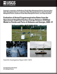
Evaluation of Actual Evapotranspiration Rates from the Operational Simplified Surface Energy Balance (SSEBop) Model in Florida and Parts of Alabama and Georgia, 2000–17
Links
- Document: Report (12.3 MB pdf)
- Data Release: USGS data release - Data sets of actual evapotranspiration rates from 2000 to 2017 for basins in Florida and parts of Alabama and Georgia, calculated using the water-balance method, the bias-corrected Operational Simplified Surface Energy Balance (SSEBop) model, and the land-use crop coefficients model
- Download citation as: RIS | Dublin Core
Abstract
Evapotranspiration (ET) is the water-vapor flux transported from the surface of the Earth into the atmosphere and is the sum of surface water directly evaporated and subsurface water transpired by plants. ET rates are commonly estimated by using potential or reference ET, which might differ from actual ET rates. Actual evapotranspiration (ETa) rates can be estimated by using the Operational Simplified Surface Energy Balance (SSEBop) model. This report evaluates SSEBop ETa rates at the point and basin scales in Florida and parts of Alabama and Georgia for 2000–17. ETa rates computed by using data from 24 micrometeorological stations in Florida are referred to as mETa rates and were used to quantify biases in the SSEBop ETa rates, stratified by generalized land-use type. Bias was computed as mETa minus SSEBop ETa rates for given generalized land-use types, and bias-correction equations were computed by using least-squares regressions. In addition to mETa rates at station locations, annual average ETa rates calculated from the application of a water-balance method to 55 basins in Florida and parts of Alabama and Georgia were used to assess the accuracy of the annual SSEBop ETa rates at the basin scale. Another independent model used to simulate ETa rates was based on monthly reference ET from the statewide daily reference evapotranspiration (ETo) gridded dataset for Florida computed by using Geostationary Operational Environmental Satellite estimates of solar radiation (GOES ETo). ETa at grid points was computed as monthly GOES ETo multiplied by ratios of monthly mETa to GOES ETo, computed at micrometeorological stations and stratified by each generalized land-use type.
The coefficient of determination (R2) between monthly mETa and SSEBop ETa rates for all stations combined improved from 0.37 before bias correction of SSEBop ETa rates to 0.79 after the bias correction stratified by land-use type. For individual land-uses types, R2 varied from 0.59 for the monthly mETa at a station in the land-use type forest to 0.82 for the monthly mETa at stations in the land-use type shallow-water-table pasture. Root-mean-square error (RMSE) was computed as a function of the difference between SSEBop ETa rates and mETa rates. RMSE of monthly SSEBop ETa rates was 1.27 inches per month before the bias corrections improved to 0.73 inch per month after the bias corrections. RMSE for bias-corrected annual SSEBop ETa rates based on micrometeorological stations with complete years of records ranged from 2.01 inches per year (in/yr) for the land-use type of agriculture to 5.73 in/yr for the land-use type of deep water-table pasture, or 4.96 and 21.21 percent errors relative to annual mETa rates, respectively. Bias-corrected annual SSEBop ETa rates were also compared to annual ETa rates computed by using a water-balance method (wbETa) for 55 basins in Florida. Differences in bias-corrected average annual SSEBop ETa rates and average annual wbETa rates for the 55 basins ranged from −3.67 to 5.29 in/yr (−9.24 to 17.36 percent). RMSE when computed as a function of the differences between annual SSEBop ETa rates and wbETa rates decreased, on average, from 4.13 in/yr for the uncorrected bias SSEBop ETa rates to 1.95 in/yr for the bias-corrected SSEBop rates. The average annual bias-corrected SSEBop ETa rates, from all basins, was 36.46 in/yr or 3.41 percent lower than the average annual wbETa rate of 37.79 inches.
Bias in SSEBop ETa rates varies based on time step (monthly versus annual), scale (point, basin, statewide), and land-use type. Applications to hydrologic models should consider bias relative to the inherent error in models. Bias-corrected SSEBop ETa rates could be used as calibration targets in models of hydrologic processes, such as groundwater models. Annual bias in SSEBop ETa introduced to the model calibration is typically below the margin of error associated with typical residuals in model simulations, depending on scale. Surface-water and groundwater-flow models with RMSEs on the order of a few feet could benefit from bias-corrected SSEBop values of ETa.
Suggested Citation
Sepúlveda, N., 2021, Evaluation of actual evapotranspiration rates from the Operational Simplified Surface Energy Balance (SSEBop) model in Florida and parts of Alabama and Georgia, 2000–17: U.S. Geological Survey Scientific Investigations Report 2021–5072, 66 p., https://doi.org/10.3133/sir20215072.
ISSN: 2328-0328 (online)
Study Area
Table of Contents
- Acknowledgments
- Abstract
- Introduction
- Purpose and Scope
- Models Used to Simulate Actual Evapotranspiration
- Evaluation of SSEBop Rates
- Model Limitations
- Summary and Conclusions
- References Cited
| Publication type | Report |
|---|---|
| Publication Subtype | USGS Numbered Series |
| Title | Evaluation of actual evapotranspiration rates from the Operational Simplified Surface Energy Balance (SSEBop) model in Florida and parts of Alabama and Georgia, 2000–17 |
| Series title | Scientific Investigations Report |
| Series number | 2021-5072 |
| DOI | 10.3133/sir20215072 |
| Publication Date | August 24, 2021 |
| Year Published | 2021 |
| Language | English |
| Publisher | U.S. Geological Survey |
| Publisher location | Reston, VA |
| Contributing office(s) | Caribbean-Florida Water Science Center |
| Description | Report: x, 66 p.; Data Release |
| Country | United States |
| State | Alabama, Florida, Georgia |
| Online Only (Y/N) | Y |


