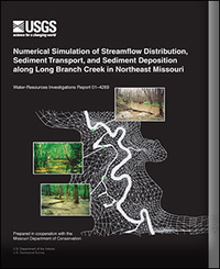
Numerical Simulation of Streamflow Distribution, Sediment Transport, and Sediment Deposition along Long Branch Creek in Northeast Missouri
Links
- Document: Report (pdf)
- Additional Report Piece: Films
- NGMDB Index Page: National Geologic Map Database Index Page
- Download citation as: RIS | Dublin Core
Abstract
This report presents the results of a study conducted by the U.S. Geological Survey in cooperation with the Missouri Department of Conservation to describe the hydrology, sediment transport, and sediment deposition along a selected reach of Long Branch Creek in Macon County, Missouri. The study was designed to investigate spatial and temporal characteristics of sediment deposition in a remnant forested riparian area and compare these factors by magnitude of discharge events both within and outside the measured range of flood magnitudes.
The two-dimensional finite-element numerical models RMA2-WES and SED2D-WES were used in conjunction with measured data to simulate streamflow and sediment transport/deposition characteristics during 2-, 5-, 10-, and 25-year recurrence interval floods. Spatial analysis of simulated sediment deposition results indicated that mean deposition in oxbows and secondary channels exceeded that of the remaining floodplain areas during the 2-, 5-, 10-, and 25-year recurrence interval floods. The simulated mass deposition per area for oxbows and secondary channels was 1.1 to 1.4 centimeters per square meter compared with 0.1 to 0.60 centimeters per square meter for the remaining floodplain.
The temporal variability of total incremental floodplain deposition during a flood was found to be strongly tied to sediment inflow concentrations. Most floodplain deposition, therefore, occurred at the beginning of the streamflow events and corresponded to peaks in sediment discharge. Simulated total sediment deposition in oxbows and secondary channels increased in the 2-year through 10-year floods and decreased in the 25- year flood while remaining floodplain deposition was highest for the 25-year flood.
Despite increases in sediment inflows from the 2-year through 25-year floods, the retention ratio of sediments (the ratio of floodplain deposition to inflow load) was greatest for the 5-year flood and least for the 25-year flood. The decrease in retention ratio at greater flows is likely the result of higher velocities on the floodplain, resulting in higher bed shear stress, greater suspension time of deposited material, and greater sediment transport through the system.
Simulated sediment deposition was most sensitive to sediment inflow concentrations and modification of floodplain roughness—factors that can be controlled through management practices. The increase in floodplain sediment deposition resulting from a simulated increase in vegetation density (increase in floodplain roughness from a Manning's n of 0.11 to 0.12) was 142,000 kilograms, or 6.5 percent for a 10-year recurrence interval flood. This increase was comparable to total oxbow and secondary channel deposition mass in the simulations, but would result in a mean increase in floodplain deposition thickness of only 0.025 centimeter.
The hydrodynamic model results show the importance of the secondary channels and meander cutoff channels in this system because these areas quickly bring floodwaters and sediment to areas not close to the main channel. The meander cutoff channels in the simulation also effectively decrease flow and velocities in some main channel sections thereby affecting sediment deposition in the vicinity of these features.
Suggested Citation
Heimann, D.C., 2001, Numerical simulation of streamflow distribution, sediment transport, and sediment deposition along Long Beach Creek in Northeast Missouri: U.S. Geological Survey Water-Resources Investigations Report 2001-4269, Report: vi, 61 p.; Films, https://doi.org/10.3133/wri014269.
Study Area
Table of Contents
- Abstract
- Introduction
- Study Approach
- Simulation of Streamflow Distribution
- Simulation of Sediment Transport and Deposition
- Summary
- References Cited
| Publication type | Report |
|---|---|
| Publication Subtype | USGS Numbered Series |
| Title | Numerical simulation of streamflow distribution, sediment transport, and sediment deposition along Long Beach Creek in Northeast Missouri |
| Series title | Water-Resources Investigations Report |
| Series number | 2001-4269 |
| DOI | 10.3133/wri014269 |
| Year Published | 2001 |
| Language | English |
| Publisher | U.S. Geological Survey |
| Publisher location | Reston, VA |
| Contributing office(s) | Missouri Water Science Center |
| Description | Report: vi, 61 p.; Films |
| Country | United States |
| State | Missouri |
| Other Geospatial | Long Branch Creek |


