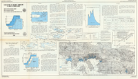
Floods of April 18, 1983 on St. Thomas and St. John, U.S. Virgin Islands
Links
- Plate: Plate 1 (pdf)
- Download citation as: RIS | Dublin Core
Abstract
The U.S. Virgin Islands of St. Thomas and St. John experienced the most intense rainfall event in recorded history on April 18, 1983. Rainfall intensities of 2.5 inches per hour, and more than 16 inches in 18 hours were recorded. Almost instantaneous runoff caused widespread flooding near the coastlines of both islands. Parts of Charlotte Amalie in St. Thomas were inundated with four feet or more of mud and flood water. Harry S. Truman Airport was flooded for two days with two to three feet of ponded water. On St. John, rural areas near Guinea Guy, Fish Bay, and Coral Bay were flooded.
Study Area
| Publication type | Report |
|---|---|
| Publication Subtype | USGS Numbered Series |
| Title | Floods of April 18, 1983 on St. Thomas and St. John, U.S. Virgin Islands |
| Series title | Water-Resources Investigations Report |
| Series number | 84-4184 |
| DOI | 10.3133/wri844184 |
| Year Published | 1984 |
| Language | English |
| Publisher | U.S. Geological Survey |
| Contributing office(s) | Caribbean Water Science Center |
| Description | 1 Plate: 37.33 x 21.50 inches |
| Country | United States |
| State | Virgin Islands |
| Other Geospatial | St. John, St. Thomas |
| Online Only (Y/N) | N |
| Additional Online Files (Y/N) | N |

