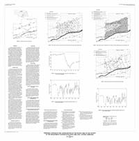
Temporal changes in the configuration of the water table in the vicinity of the management systems evaluation area site, central Nebraska
Links
- Plate: Plate 1 (pdf)
- Download citation as: RIS | Dublin Core
Abstract
Suggested Citation
Kilpatrick, J.M., 1996, Temporal changes in the configuration of the water table in the vicinity of the management systems evaluation area site, central Nebraska: U.S. Geological Survey Water-Resources Investigations Report 94-4173, 1 Plate: 39.36 x 39.77 inches, https://doi.org/10.3133/wri944173.
Study Area
| Publication type | Report |
|---|---|
| Publication Subtype | USGS Numbered Series |
| Title | Temporal changes in the configuration of the water table in the vicinity of the management systems evaluation area site, central Nebraska |
| Series title | Water-Resources Investigations Report |
| Series number | 94-4173 |
| DOI | 10.3133/wri944173 |
| Year Published | 1996 |
| Language | English |
| Publisher | U.S. Geological Survey |
| Publisher location | Reston, VA |
| Contributing office(s) | Toxic Substances Hydrology Program |
| Description | 1 Plate: 39.36 x 39.77 inches |
| Country | United States |
| State | Nebraska |
| Other Geospatial | Platte River, Wood River |

