Scientific Investigations Map 2940
Pacific NW Geologic Mapping Project
Geologic maps of the North Cascades
Kt
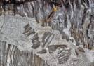
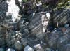
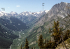
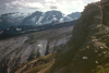
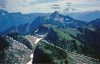
-2. Tenpeak Mountain [SRse] viewed from the Honeycomb Glacier to the west. Dark tonalite (
Kt
) forms the peak.
Photographed in June 1961.
Other photos that show unit
Kt
:
Previous Photo
Next Photo
Photo Indices:
Captions (Additional photos home)
|
Map
|
Young rocks and deposits
|
Older rocks west
|
Older rocks east