|
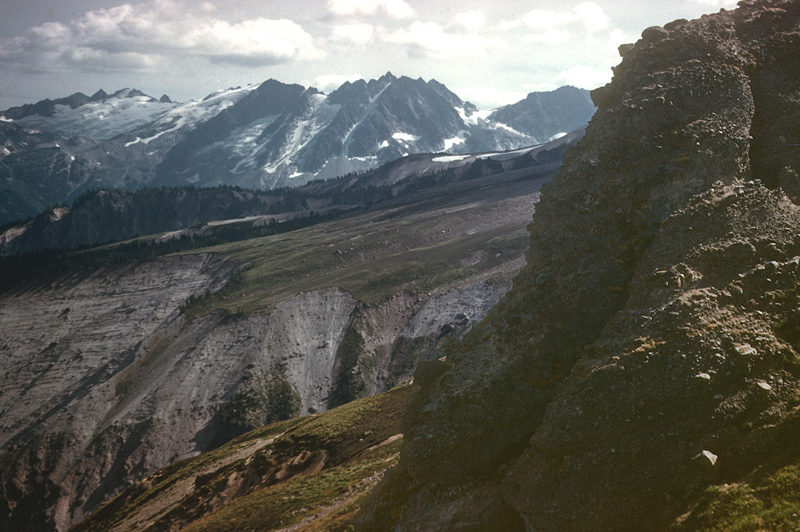
Qlh-1. View south from point near Gamma Peak [SRse] across bedded lahars (Qlh) from Glacier Peak volcano, out of view to west (right). Foreground exposure is tuffaceous conglomerate capping tuff of Gamma Ridge caldera (QTcc). Tenpeak Mountain on skyline is composed of tonalite and tonalite gneiss (Kt) of the Tenpeak pluton, a Late Cretaceous stitching pluton in the Wenatchee block. Ridge in middle distance is capped with lava from Glacier Peak volcano (Qcav). Photographed in 1961.. View image with annotation
|