|
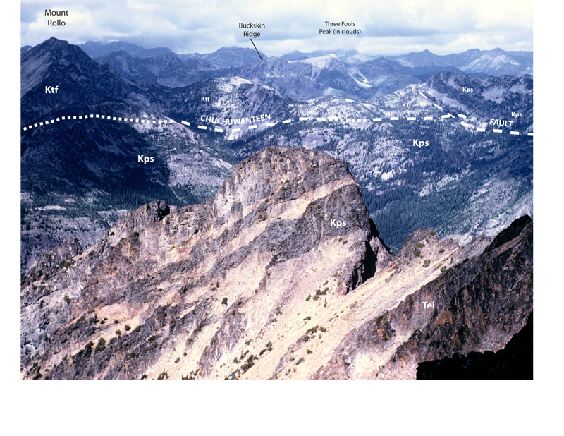
Tei-1. View west from Blackcap Mountain [RMnw] across upper Eureka Creek. In the foreground ridge, thick granite sills of the Eocene Monument Peak stock (Tei) sheath the pluton. They intruded Cretaceous sedimentary rocks of the Pasayten Group (onlap assemblage, Kps). Mount Rolo is rocks of the Three Fools sequence (rocks of the Methow Ocean, Ktf, here the Harts Pass Formation) in the upper plate of the Chuchuwanteen Thrust. Pasayten Group rocks that stratigraphically overlie the Three Fools sequence are visible in Buckskin Ridge across the (hidden) Middle Fork Pasayten River. Contact (thin line) and fault (heavy line) dashed where approximately located and dotted where hidden in this view. View image without annotation
|