|
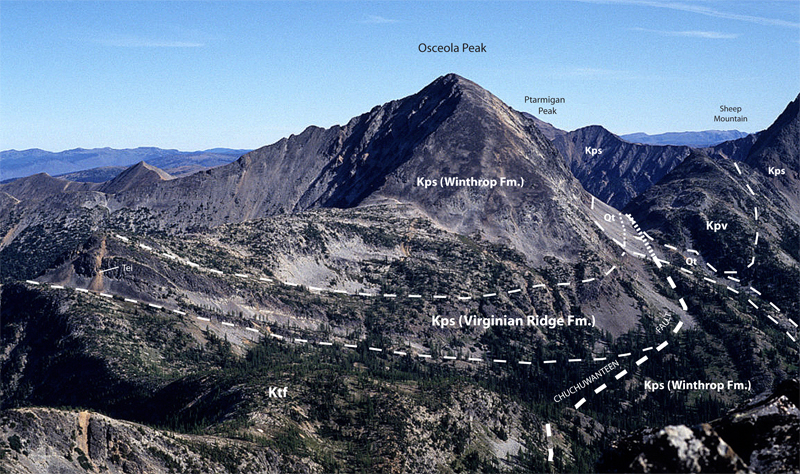
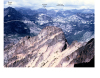
Kps-2. View northeast from Mount Rolo of thick-bedded fluvial sandstone of the Pasayten Group (Kps) exposed on Osceola Peak [RMnw] overlying marine rocks of the Three Fools Sequence of Haugerud and others (2002) (rocks of the Methow Ocean, Ktf). Rocks along the ridge to Osceola Peak are in the upper plate of the Chuchuwanteen thrust fault; the same units crop out in the lower plate of the thrust below and to the east. Orange streaks are dacite porphyry dikes, offshoots of the granite Monument Peak stock (Tei). Kpv, volcanic rocks of the Pasayten Group; Qt, talus. Contacts (thin lines) and faults (thick lines) dashed where approximately located and dotted where concealed (covered or hidden). View image without annotation
|