|
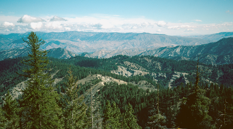
Tes-1. View northeast from Tronsen Ridge [Wnw]. Timbered hills in the foreground expose early extensional fluvial sandstone and shale of the early and middle Eocene Swauk Formation (Tees). The Leavenworth Fault, hidden in a canyon, separates the Swauk Formation from well-exposed, north- (left-) dipping strata of the middle Eocene Chumstick Formation (Tes) within the Chiwaukum graben. The Entiat Fault, in the distance, separates Chumstick Formation from Swakane Biotite Gneiss (Kswg) and Napeequa Schist (Kns) northeast of the graben. Badger Mountain, far to the east, is Miocene Yakima Basalt (Tyg) that overlies schist, gneiss, Eocene sandstones, and the Entiat Fault. The faults bounding the Chiwaukum Graben are not active; the relief along the scarps mostly reflects differing resistance to erosion of the flanking rocks. Entiat Fault dashed where approximately located and dotted where hidden in this view. View image with annotation
|