|
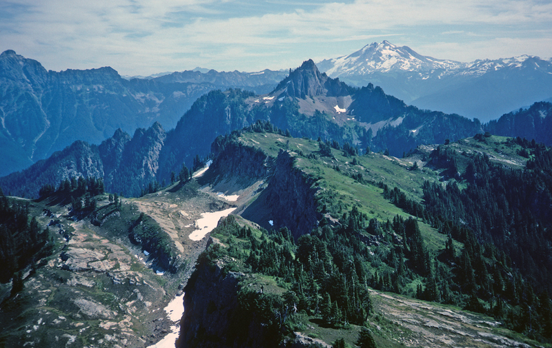
Tev-1. View east from Stillaguamish Peak [SRse] across minor faults jostling light-colored sandstone interbeds in volcanic rocks of the extensional deposits (Tev; here, the Barlow Pass Volcanics of Vance, 1957a,b). Mount Forgotten is held up by thick dacite dikes associated with the volcanics. Glacier Peak is a Quaternary volcano (Qcav) erupted on older metamorphic rocks of the Wenatchee block. Mount Pugh and ridge to south consist of a tonalite and tonalite gneiss stitching pluton (Kt). Faults dashed where approximately located and dotted where hidden. View image with annotation
|