U.S. Geological Survey Scientific Investigations Map 3094
Abstract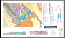
The Inyo Mountains are located in east-central California between Owens Valley on the west and Saline Valley on the east. This map encompasses the southernmost part of the Inyo Mountains and vicinity, which is centered on the high plateau of Conglomerate Mesa and extends from Owens Valley on the west to the Santa Rosa Hills, Lee Flat, and the Nelson Range on the east. The area includes parts of the Cerro Gordo Peak, Nelson Range, Keeler, and Santa Rosa Flat 7.5’ quadrangles. Sedimentary and volcanic rocks, unconformities, and structural features exposed in the southern Inyo Mountains region provide information critical for reconstructing the complex Paleozoic and Mesozoic tectonic evolution of the southwestern United States. Ordovician to Cretaceous rocks in the map area record a long geologic history during which the continental margin of the western United States gradually changed from a passive tectonic setting in the early and middle Paleozoic to an active tectonic setting in the Jurassic and Cretaceous. A major highlight of the map area is the unusually complete record of late Paleozoic to earliest Mesozoic (Pennsylvanian to Triassic) deformation and sedimentation that marked the transition between the passive and active margin settings. The area also provides an excellent record of Jurassic to Cretaceous deformation and igneous activity that characterized the middle to late Mesozoic active margin. This map provides a detailed depiction of all the Paleozoic and Mesozoic rocks and structural features known in the area. The area also contains important exposures of upper Cenozoic rocks related to the evolution of the Basin and Range province, although detailed mapping of these rocks was beyond the scope of this study. |
First posted November 21, 2009 For additional information, contact: This report is available via print on demand. Part of this report is presented in Portable Document Format (PDF). Download the latest version of Adobe Reader, free of charge. |
Stone, Paul, Swanson, Brian J., Stevens, Calvin H., Dunne, George C., and Priest, Susan S., 2009, Geologic map of the southern Inyo Mountains and vicinity, Inyo County, California (ver. 1.1, September, 2014): U.S. Geological Survey Scientific Investigations Map 3094, scale 1:24,000, 1 sheet, includes 22 p. pamphlet, [https://pubs.usgs.gov/sim/3094/].

![]() U.S. Department of the Interior |
U.S. Geological Survey
U.S. Department of the Interior |
U.S. Geological Survey
URL: http://
pubsdata.usgs.gov
/pubs/sim/3094/index.html
Page Contact Information: USGS Publications Team
Page Last Modified: Thursday, 01-Dec-2016 17:17:44 EST