Scientific Investigations Report 2006-5023
U.S. GEOLOGICAL SURVEY
Scientific Investigations Report 2006-5023

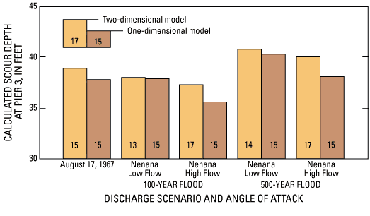
Figure 9. Depth of pier scour, calculated using output from one- and two-dimensional hydraulic models, and angle of attack at bridge pier 3 for five discharge scenarios representing floods on the Tanana River near Nenana, Alaska.
See table 5 for values.
For more information about USGS activities in Alaska, visit the USGS Alaska Water Science Center home page.