Scientific Investigations Report 2007–5050
U.S. GEOLOGICAL SURVEY
Scientific Investigations Report 2007–5050
Version 1.1, April 2010
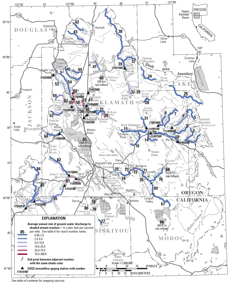
Figure 7. Principal areas of ground-water discharge to streams and major springs in the upper Klamath Basin, Oregon and California, and selected stream-gaging stations. Shading along main stem reaches represents ground-water discharge (in cubic feet per second per mile) averaged along the entire shaded reach. The actual location of ground-water discharge may be localized. Shading along headwater streams represents the ground-water discharge averaged over the shaded reach and includes ground-water discharge to tributaries. See table 6 for detailed descriptions of measurement locations.

![]() U.S.
Department of the Interior | U.S. Geological
Survey
U.S.
Department of the Interior | U.S. Geological
Survey
Persistent URL: https://pubs.water.usgs.gov/sir20075050
Page Contact Information: Publications Team
Page Last Modified: Thursday, 01-Dec-2016 19:42:22 EST
