Scientific Investigations Report 2009–5020
ABSTRACT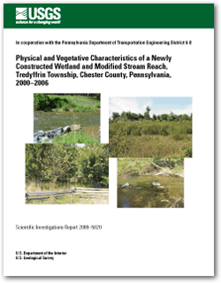
To compensate for authorized disturbance of naturally occurring wetlands and streams during roadway improvements to U.S. Highway 202 in Chester and Montgomery Counties, Pa., the Pennsylvania Department of Transportation (PennDOT) constructed 0.42 acre of emergent wetland and 0.94 acre of scrub-shrub/forested wetland and modified sections of a 1,600-foot reach of Valley Creek with woody riparian plantings and streambank-stabilization structures (including rock deflectors). In accordance with project permits and additional guidance issued by the U.S. Army Corps of Engineers, the U.S. Geological Survey (USGS), in cooperation with PennDOT, collected data from 2000 through 2006 to quantify changes in 1) the vegetation, soils, and extent of emergent and scrub-shrub/forested parts of the constructed wetland, 2) the profile, dimension, and substrate in the vicinity of rock deflectors placed at two locations within the modified stream reach, and 3) the woody vegetation within the planted riparian buffer. The data for this investigation were collected using an approach adapted from previous investigations so that technology and findings may be more easily transferred among projects with similar objectives. Areal cover by planted and non-planted vegetation growing within the emergent and scrub-shrub/forested parts of the constructed wetland exceeded 85 percent at the end of each growing season, a criterion in special condition 25c in the U.S. Army Corps of Engineers project permit. Areal cover of vegetation in emergent and scrub-shrub/forested parts of the constructed wetland exceeded 100 percent in all but one growing season. Frequent and long-lasting soil saturation favored obligate-wetland species like Typha latifolia (broadleaf cattail) and Scirpus validus (great bulrush), both of which maintained dominance in the emergent wetland throughout the study (percent cover was 20 and 78 percent, respectively, in 2006). Echinocloa crusgalli (barnyard grass), an annual invasive from Eurasia, initially established in the newly disturbed soils of the scrub-shrub/forested wetland (areal cover was 56 percent in 2000), but by 2002, E. crusgalli was not growing in any sample plots and other species including Agrostis stolonifera (creeping bent grass), Festuca rubra (red fescue), Cornus spp. (dogwood species), and Salix nigra (black willow) were becoming more common. Sal. nigra contributed 30-percent cover in the scrub-shrub/forested wetland part by fall 2003. Rapid colonization of this species in subsequent years increased annual cover through 2006, when 15- to 25-foot tall Sal. nigra trees dominated the tree/shrub stratum (48 percent of the areal cover in 2006). The understory of the scrub-shrub/forested wetland was mostly shaded because of the canopy of Sal. nigra trees. Herbaceous species growing under and near the margins of the canopy included Ag. stolonifera and Ty. latifolia (29- and 23-percent areal cover, respectively). Flows in Valley Creek are responsible for transporting sediment and shaping the channel. Annual mean streamflow during the period the modified stream reach was monitored ranged from 15.2 cubic feet per second (ft3/s) in the 2002 water year to 53.0 ft3/s in the 2004 water year. This is a range of about 55 percent lower to 58 percent higher than the annual mean streamflow for the period of record. Despite the variability in streamflow, longitudinal profiles surveyed near rock deflectors in two short (100-foot) reaches within the modified stream reach maintained a constant slope throughout the monitoring period, most likely because of the presence of bedrock control. Cross-section geometry in the upstream reach was virtually unchanged during the monitoring period but 10 feet of bank migration was measured downstream, leaving the rock deflectors in mid-stream. As indicated by the change in channel morphology at the downstream reach, it is apparent that the rock deflectors were ineffective at adequately protecting the bank from erosion. Particle distributions in both reaches, in general, became more fine over most of the monitoring period, with the exception of the 2006 assessment, which showed coarsening in the 15th- and 50th-percentile size categories at the upstream reach. There was no evidence of deposition associated with the coarsening of the upstream reach in 2006, indicating transport capability was maintained or increased. The trend toward a finer particle distribution in the downstream reach suggests a decrease in sediment transport commonly associated with channel widening. Because of replacement plantings in 2001 and 2002, the most reliable time frame for interpretation of trends in the number and well being of riparian plantings is 2003–2006. The most prevalent tree species in 2003 was Platanus occidentalis (sycamore; 63 individuals), followed by Carpinus caroliniana (ironwood; 35), Quercus palustris (pin oak; 33), Alnus serrulata (smooth alder; 30), Acer rubrum (red maple; 26), Acer saccharinum (silver maple; 17), and Sal. nigra (10). The most prevalent shrubs in 2003 were Cornus spp. (98 individuals), followed by Salix discolor (pussy willow; 51), Physocarpus opulifolius (ninebark) and Viburnum dentatum (arrowood) (each with 28 individuals), Clethra alnifolia (summersweet; 27), and Spirea virginiana (Virginia spirea; 4). Trees and shrubs that appreciably declined in number between 2003 and 2006, including Sal. nigra, Al. serrulata, Ac. saccharinum, Sa. discolor, and Cl. alnifolia, generally exhibited more stress in 2003 compared to their counterparts that remained nearly constant or increased in number throughout the study. Despite replacement of dead individuals in 2001 and 2002, planted trees decreased from 214 in 2001 to 171 in 2006 and shrubs decreased from 546 in 2001 to 225 in 2006. By contrast, the combined number of the two most prevalent non-planted species [Acer negundo (box elder) and Gymnocladus dioicus (Kentucky coffee tree)] more than doubled over the same time period (from 110 to 244 individuals). The density of planted species at the end the study was 382 plants per acre compared to 329 plants per acre for non-planted species. |
First posted July 1, 2009 For additional information contact: Part or all of this report is presented in Portable Document Format (PDF); the latest version of Adobe Reader or similar software is required to view it. Download the latest version of Adobe Reader, free of charge. |
Chaplin, J.J., White, K.E., and Olson, L.E., 2009, Physical and vegetative characteristics of a newly constructed wetland and modified stream reach, Tredyffrin Township, Chester County, Pennsylvania, 2000–2006: U.S. Geological Survey Scientific Investigations Report 2009-5020, 64 p.
Abstract
Introduction
Monitoring Methods
Physical and Vegetative Results
Summary
References Cited

![]() U.S. Department of the Interior |
U.S. Geological Survey
U.S. Department of the Interior |
U.S. Geological Survey
[an error occurred while processing this directive]
URL: http://pubsdata.usgs.gov
Page Contact Information: Contact USGS
Page Last Modified: Thursday, 10-Jan-2013 19:32:38 EST
