Scientific Investigations Report 2009–5123

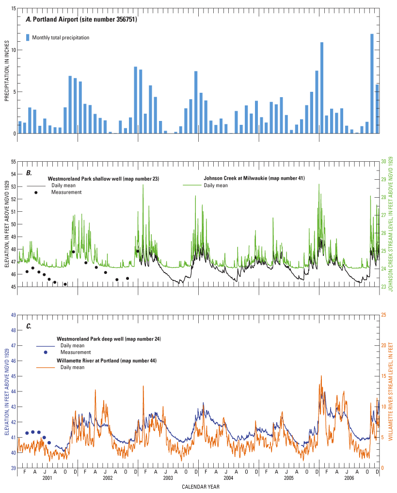
Figure 11. Precipitation at (A) Portland Airport, Oregon, (B) water level elevation in the shallow well at Westmoreland Park and water level of Johnson Creek at Milwaukie, Oregon, and (C) water level elevation in the deep well at Westmoreland Park, and level of the Willamette River at Portland, Oregon. (Willamette River stream level is set to an arbitrary gage datum. Map numbers refer to table 1.) |
For additional information contact: Director, Oregon Water Science Center Part or all of this report is presented in Portable Document Format (PDF); the latest version of Adobe Reader or similar software is required to view it. Download the latest version of Adobe Reader, free of charge. |