Scientific Investigations Report 2009–5254
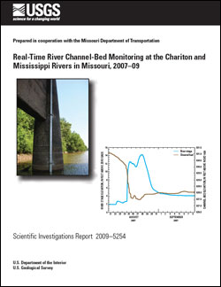
AbstractScour and depositional responses to hydrologic events have been important to the scientific community studying sediment transport as well as potential effects on bridges and other hydraulic structures within riverine systems. A river channel-bed monitor composed of a single-beam transducer was installed on a bridge crossing the Chariton River near Prairie Hill, Missouri (structure L-344) as a pilot study to evaluate channel-bed change in response to the hydrologic condition disseminated from an existing streamgage. Initial results at this location led to additional installations in cooperation with the Missouri Department of Transportation at an upstream Chariton River streamgage location at Novinger, Missouri (structure L-534) and a Mississippi River streamgage location near Mehlville, Missouri (structures A-1850 and A-4936). In addition to stage, channel-bed elevation was collected at all locations every 15 minutes and transmitted hourly to a U.S. Geological Survey database. Bed elevation data for the Chariton River location at Novinger and the Mississippi River location near Mehlville were provided to the World Wide Web for real-time monitoring. Channel-bed data from the three locations indicated responses to hydrologic events depicted in the stage record; however, notable bedforms apparent during inter-event flows also may have affected the relation of scour and deposition to known hydrologic events. Throughout data collection periods, Chariton River locations near Prairie Hill and Novinger reflected bed changes as much as 13 feet and 5 feet. Nearly all of the bed changes correlated well with the hydrographic record at these locations. The location at the Mississippi River near Mehlville indicated a much more stable channel bed throughout the data collection period. Despite missing data resulting from damage to one of the river channel-bed monitors from ice accumulation at the upstream nose of the bridge pier early in the record, the record from the downstream river channel-bed monitor demonstrated a good correlation (regardless of a 7 percent high bias) between bedform movement and the presence of bedforms surrounding the bridge as indicated by coincident bathymetric surveys using multibeam sonar. |
First posted December 18, 2009 For additional information contact: Part or all of this report is presented in Portable Document Format (PDF); the latest version of Adobe Reader or similar software is required to view it. Download the latest version of Adobe Reader, free of charge. |
Rydlund, P.H., Jr., 2009, Real-time river channel-bed monitoring at the Chariton and Mississippi Rivers in Missouri, 2007–09: U.S. Geological Survey Scientific Investigations Report 2009–5254, 27 p.
Abstract
Introduction
River Channel-Bed Monitor Installation and Data Collection
River Channel-Bed Monitor Results
River Channel-Bed Monitor Uncertainty and Limitations
Summary and Conclusions
References Cited

![]() U.S. Department of the Interior |
U.S. Geological Survey
U.S. Department of the Interior |
U.S. Geological Survey
URL: http://pubsdata.usgs.gov/pubs/sir/2009/5254/index.html
Page Contact Information: GS Pubs Web Contact
Page Last Modified: Thursday, 10-Jan-2013 19:42:13 EST
