Scientific Investigations Report 2011–5041
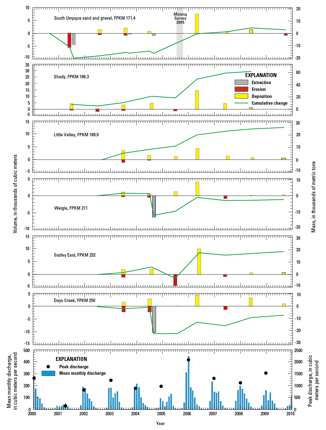
Figure 31. Gravel bar volume changes during 2001–09 at instream gravel mining sites along the South Umpqua River, Oregon. Refer to table 8 for data sources and values underlying this figure. For sites with missing surveys, cumulative totals assume no net change for the period of missing data. Mean monthly and annual (water year) peak flows are from the USGS data for streamflow-gaging station on South Umpqua River near Brockway (station 14312000). |
First posted September 29, 2011 For additional information contact: Part or all of this report is presented in Portable Document Format (PDF); the latest version of Adobe Reader or similar software is required to view it. Download the latest version of Adobe Reader, free of charge. |

![]() U.S. Department of the Interior |
U.S. Geological Survey
U.S. Department of the Interior |
U.S. Geological Survey
URL: http://pubsdata.usgs.gov/pubs/sir/2011/5041/figure31.html
Page Contact Information: GS Pubs Web Contact
Page Last Modified: Thursday, 10-Jan-2013 20:11:23 EST
