Scientific Investigations Report 2012–5062

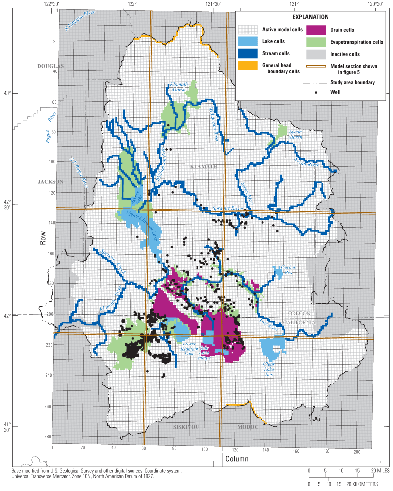
Figure 4. Upper Klamath Basin regional groundwater flow model grid and boundary conditions. Highlighted rows and columns correspond to sections shown in figure 5. |
First posted May 5, 2012 For additional information contact: Part or all of this report is presented in Portable Document Format (PDF); the latest version of Adobe Reader or similar software is required to view it. Download the latest version of Adobe Reader, free of charge. |