Scientific Investigations Report 2012–5062

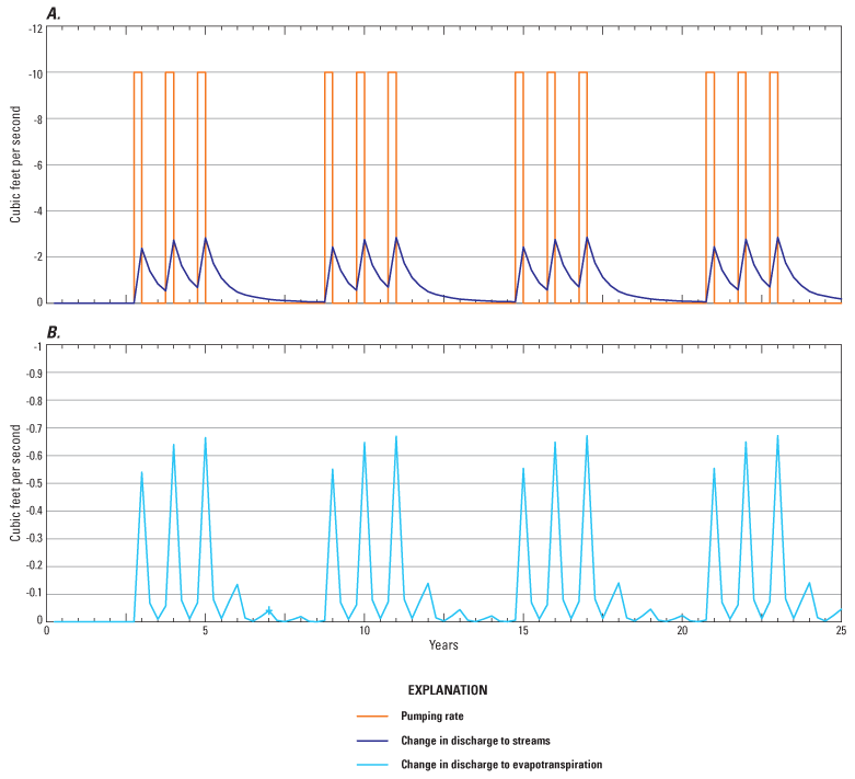
Figure 50. Simulated impacts to hydrologic boundaries due to pumping a well in model layer 2 in the upper Lost River subbasin at 10 cubic feet per second for 92 days per year (July–September) under a repeating schedule of 3 years with pumping followed by 3 years without pumping. (A) Changes in groundwater-discharge rate to streams and (B) changes in groundwater-discharge rates to drains and evapotranspiration. Only the first 25 years of the 50-year simulation are shown for clarity. |
First posted May 5, 2012 For additional information contact: Part or all of this report is presented in Portable Document Format (PDF); the latest version of Adobe Reader or similar software is required to view it. Download the latest version of Adobe Reader, free of charge. |