Scientific Investigations Report 2012–5062
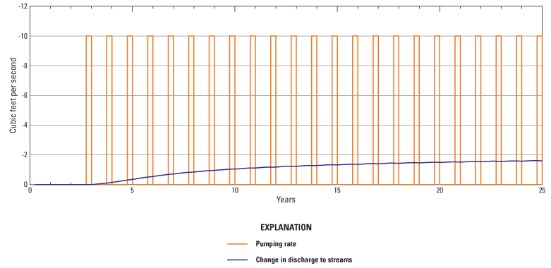
Figure 52. Simulated impacts to hydrologic boundaries due to pumping a well in model layer 3 approximately 5 miles south of Beatty, Oregon, at 10 cubic feet per second for 92 days per year (July–September) each year. Only the first 25 years of the 50-year simulation are shown for clarity. |
First posted May 5, 2012 For additional information contact: Part or all of this report is presented in Portable Document Format (PDF); the latest version of Adobe Reader or similar software is required to view it. Download the latest version of Adobe Reader, free of charge. |

![]() U.S. Department of the Interior |
U.S. Geological Survey
U.S. Department of the Interior |
U.S. Geological Survey
URL: http://pubsdata.usgs.gov/pubs/sir/2012/5062/figure52.html
Page Contact Information: GS Pubs Web Contact
Page Last Modified: Thursday, 10-Jan-2013 19:54:18 EST
