Scientific Investigations Report 2012–5062
  
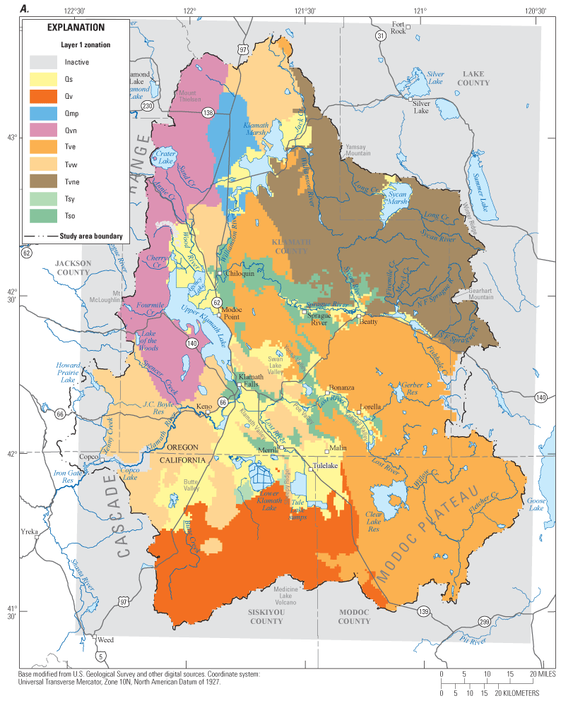
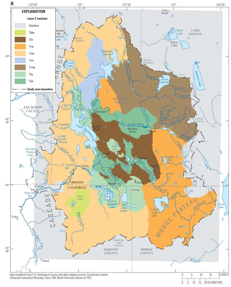
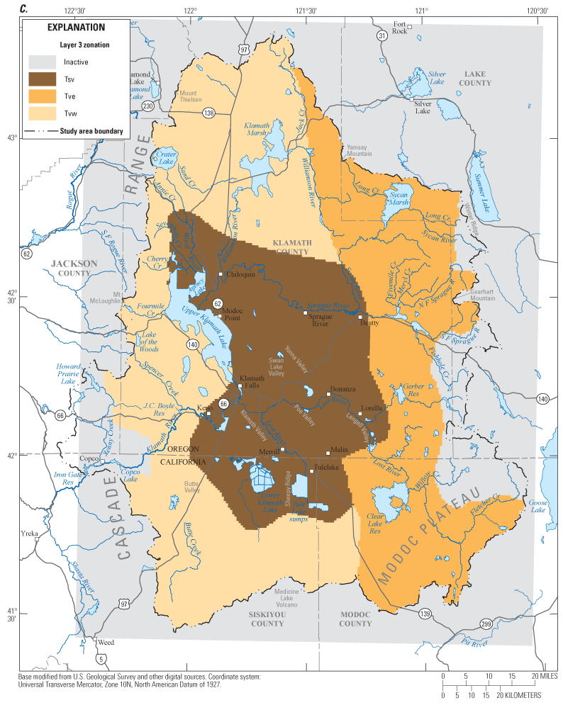
Figure 6. Upper Klamath Basin, Oregon and California, regional groundwater flow model hydraulic-conductivity zonation. (A) Layer 1 zonation; (B) Layer 2 zonation; and (C) Layer 3 zonation. Hydrogeologic unit definitions: Qs, Quaternary sediment; Qv, Quaternary volcanic deposits; Qvn, Quaternary volcanic deposits north; Qmp, Quaternary Mazama pumice; Tvn, Tertiary volcanic deposits north; Tsbv, Tertiary sediments, Butte Valley; Tsy, Tertiary sediments younger basins; Tso, Tertiary sediments older basins; Tsv, Tertiary mixed sedimentary and volcanic deposits; Tvw, Tertiary volcanic rocks west; Tve, Tertiary volcanic rocks east; Tvne, Tertiary volcanic rocks northeast. |
First posted May 5, 2012 For additional information contact: Part or all of this report is presented in Portable Document Format (PDF); the latest version of Adobe Reader or similar software is required to view it. Download the latest version of Adobe Reader, free of charge. |