Scientific Investigations Report 2013–5135

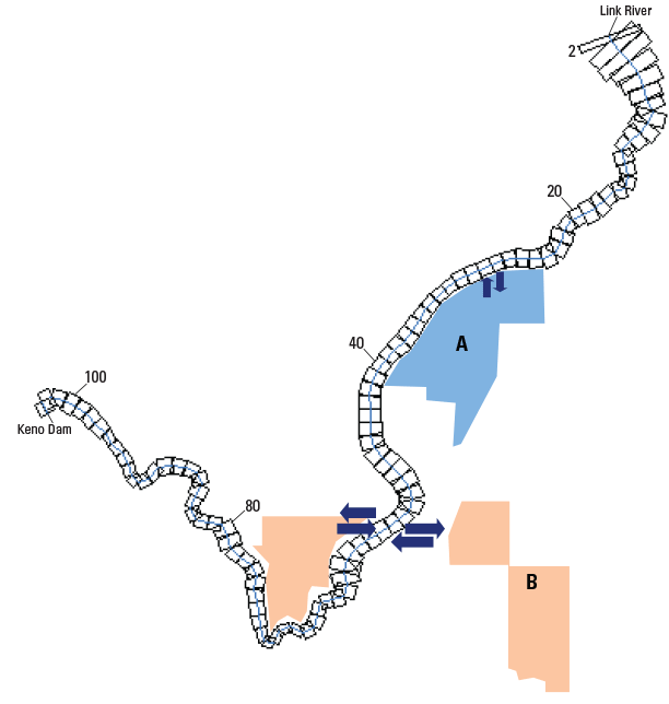
Figure 12. CE-QUAL-W2 model grid, location of wetland A and B areas, and approximate diversion and return flow points (marked with arrows) for scenario 7 simulations, Klamath River, Oregon. |
First posted July 24, 2013 For additional information contact: Part or all of this report is presented in Portable Document Format (PDF); the latest version of Adobe Reader or similar software is required to view it. Download the latest version of Adobe Reader, free of charge. |