Water Data Report AK-05-1
M.L. Jackson, M.E. Castor, J.M. Goetz, G.L. Solin, J.M. Wiles
ABSTRACT
Water resources data for the 2005 water year for Alaska consist of records of stage, discharge, and water quality of streams;
stages of lakes; and water levels and water quality of ground water. This volume contains records for water discharge at 114 gaging stations;
stage or contents only at 3 gaging stations; water quality at 37 gaging stations; and water levels for 41 observation wells. Also included are
data for 55 crest-stage partial-record stations. Additional water data were collected at various sites not involved in the systematic
data-collection program and are published as miscellaneous measurements and analyses. Some data collected during 2005 will be published in
subsequent reports. These data represent that part of the National Water Data System operated by the U.S. Geological Survey and cooperating
State and Federal agencies in Alaska.
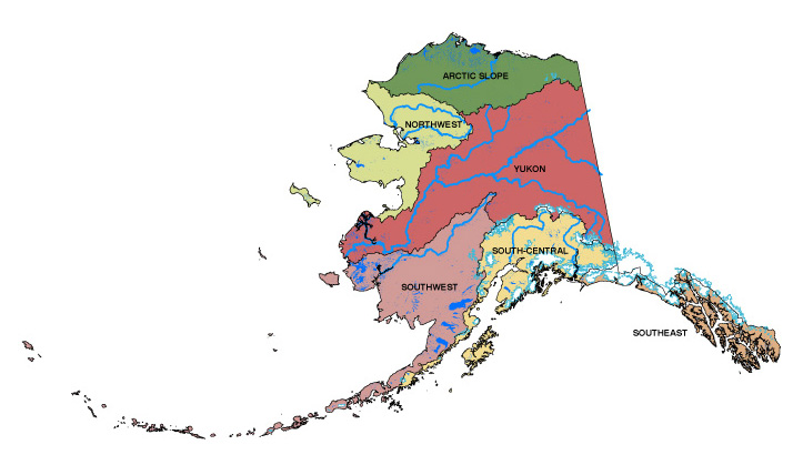
STATE OF ALASKA MAP
 Full version of the 2005 Water Resources Data Report -- 6.6 MB, PDF format Full version of the 2005 Water Resources Data Report -- 6.6 MB, PDF format
INTRODUCTORY MATERIAL
Report Information -- 136 KB, PDF format
2005 Water Year Calendar -- 32 KB, PDF format
Preface
Surface Water Records Stations Downstream Order List -- 24 KB, PDF format
Crest-stage Partial Record Stations Downstream Order List -- 21 KB, PDF format
Ground Water Wells Hydrologic Subregional List -- 17 KB, PDF format
Discontinued Surface Water Discharge or Stage-Only Stations -- 55 KB, PDF format
Discontinued Surface-Water-Quality Stations -- 44 KB, PDF format
Introduction
Cooperation
Acknowledgements
Summary of Hydrologic Conditions
Special Networks and Programs
Explanation of the Records
Explanation of Stage and Water-Discharge Records
Explanation of Water-Quality Records
Explanation of Surface-Water-Quality Data
Explanation of Ground-Water-Level Records
Explanation of Ground-Water-Quality Data
Access to USGS Water Data
Definition of Terms -- 173 KB, PDF format
Glossaries
Conversion Factors -- 35 KB, PDF format
WATER DATA
Continuous-Record Surface-Water Discharge or Stage-only Stations
Map 1-Locations of Gaging Stations -- 179 KB, PDF format
Southeast Region -- 927 KB, PDF format
South-Central Region -- 773 KB, PDF format
Southwest Region -- 224 KB, PDF format
Yukon Region -- 435 KB, PDF format
Northwest Region -- 112 KB, PDF format
Arctic Slope Region -- 172 KB, PDF format
Partial-Record Discharge Stations
Map 2-Locations of Crest-Stage Partial-Record Stations -- 177 KB, PDF format
Southeast Region -- 58 KB, PDF format
South-Central Region -- 163 KB, PDF format
Southwest Region -- 87 KB, PDF format
Yukon Region -- 476 KB, PDF format
Northwest Region -- 117 KB, PDF format
Arctic Slope Region -- 68 KB, PDF format
Miscellaneous Discharge Measurement and Water-Quality Sample Sites
Miscellaneous Sites -- 65 KB, PDF format
Map 3-Locations of Miscellaneous Water-Quality Sample Sites -- 178 KB, PDF format
Analyses of Samples Collected at Miscellaneous Sites -- 148 KB, PDF format
Analyses of Samples Collected at Miscellaneous Lake Sites -- 202 KB, PDF format
Ground-Water-Level and Water-Quality Record Stations
Map 4-Locations of Ground-Water Observations Wells -- 182 KB, PDF format
Ground-Water-Level and Water-Quality Data -- 534 KB, PDF format
Index -- 92 KB, PDF format
|