
Concentrations and annual fluxes for selected
water-quality constituents from the USGS National
Stream Quality Accounting Network (NASQAN),
1996-2000
By Valerie J. Kelly, Richard P. Hooper, Brent
T. Aulenbach, and Mary Janet
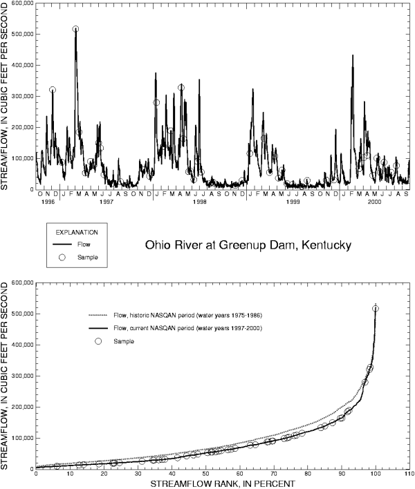
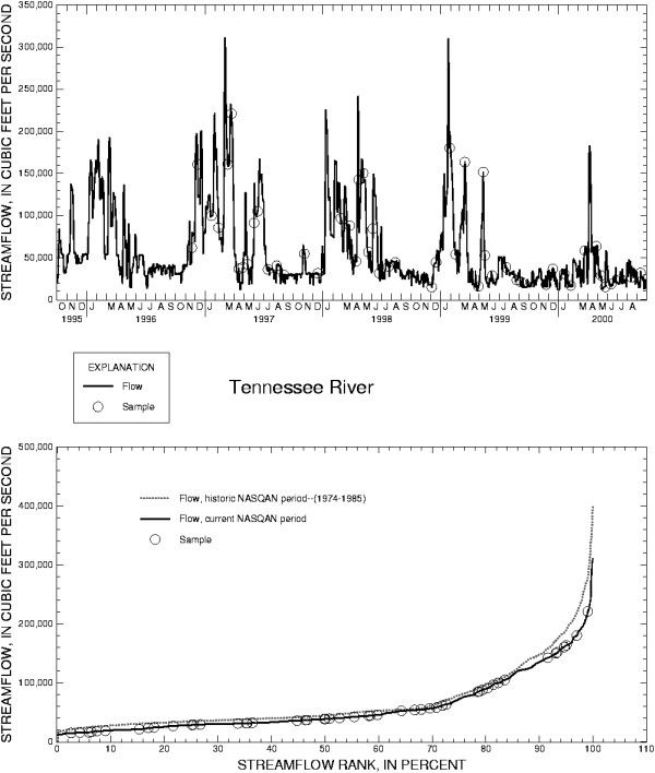
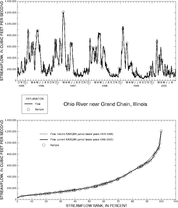
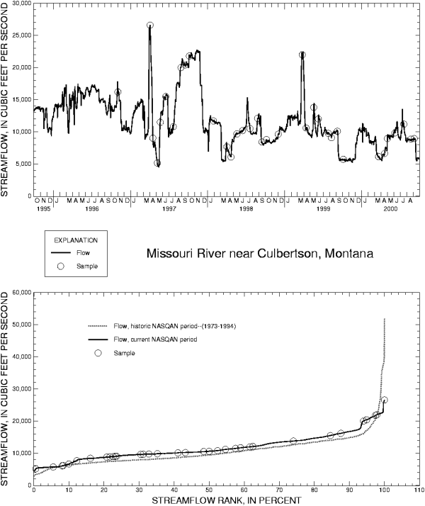
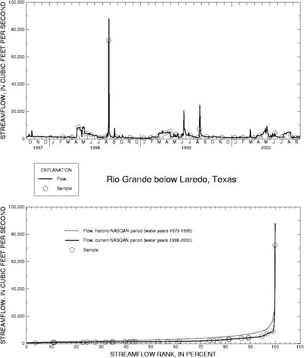
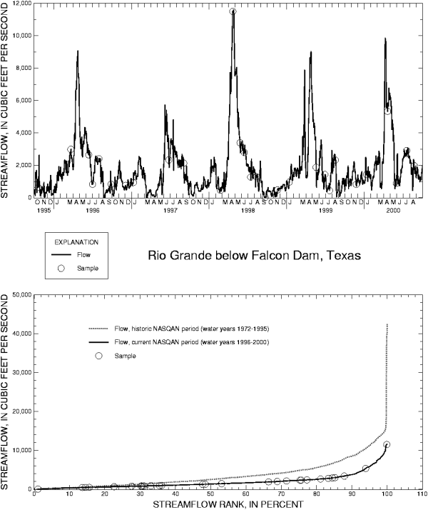
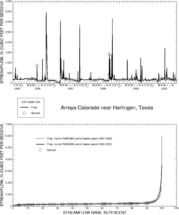
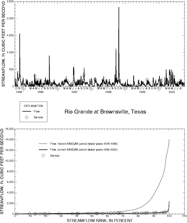
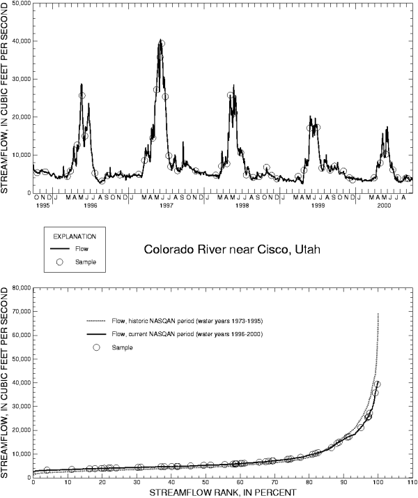
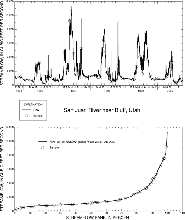
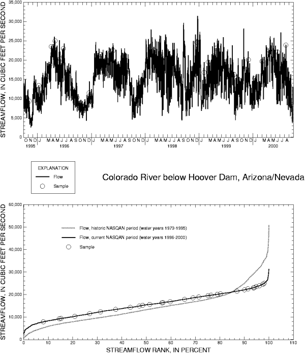
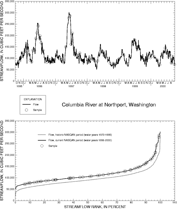
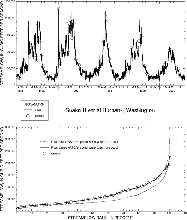
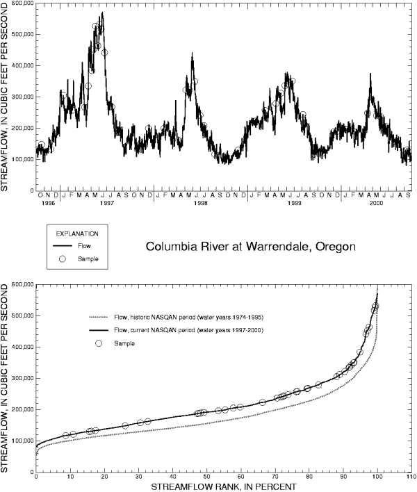
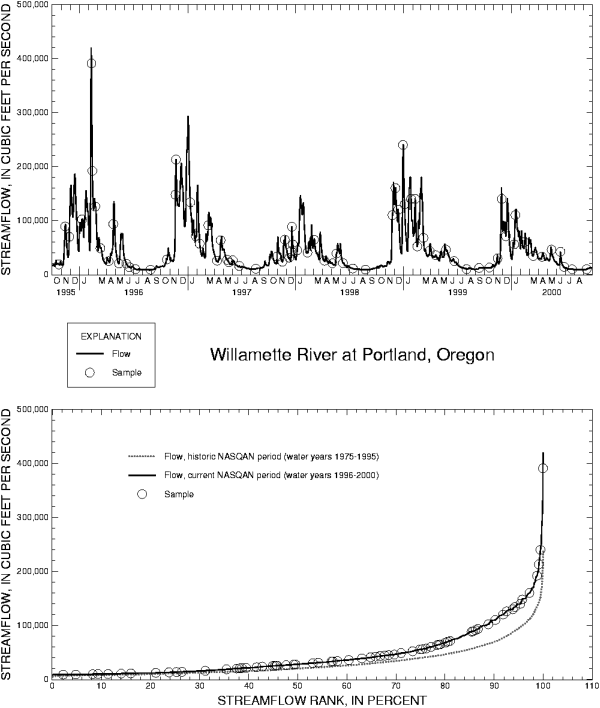
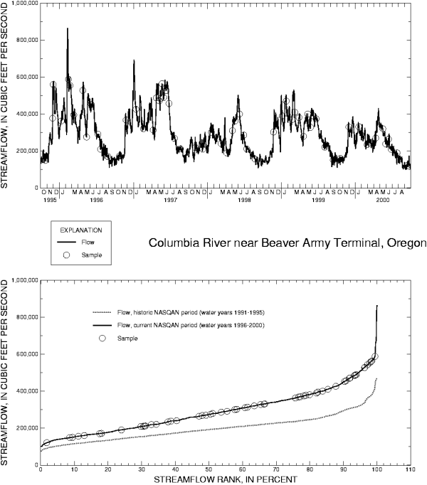
Sampling Coverage
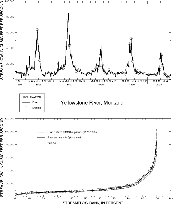
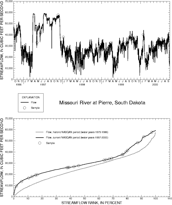
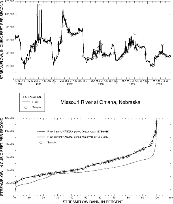
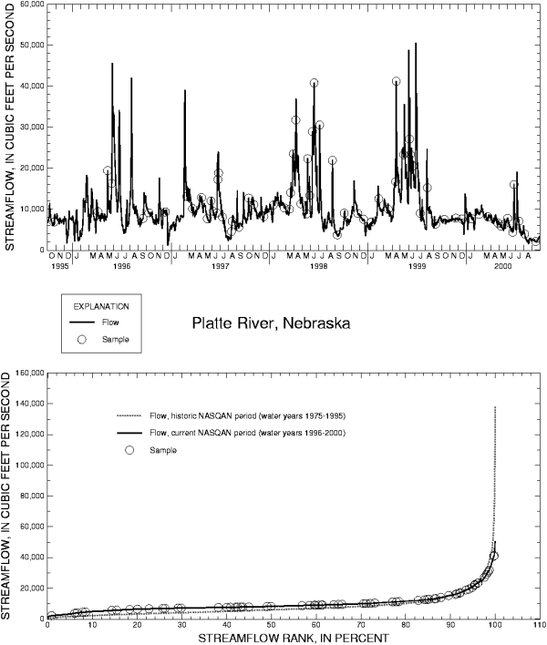
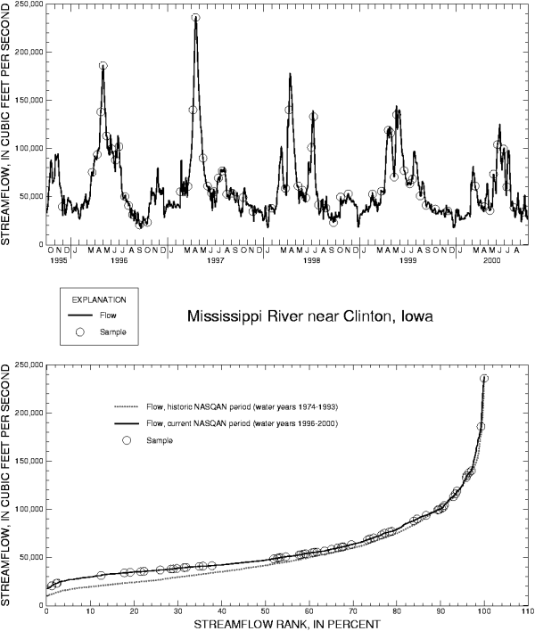
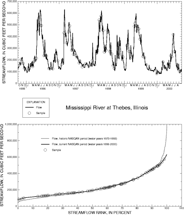
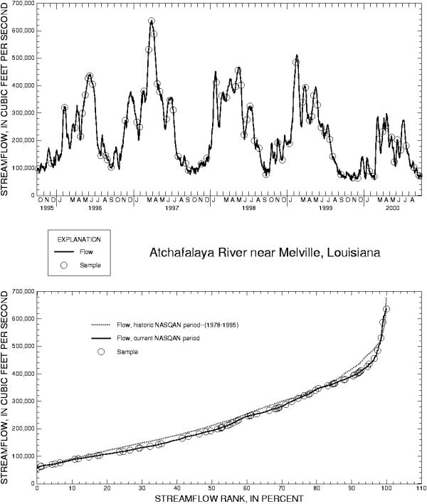
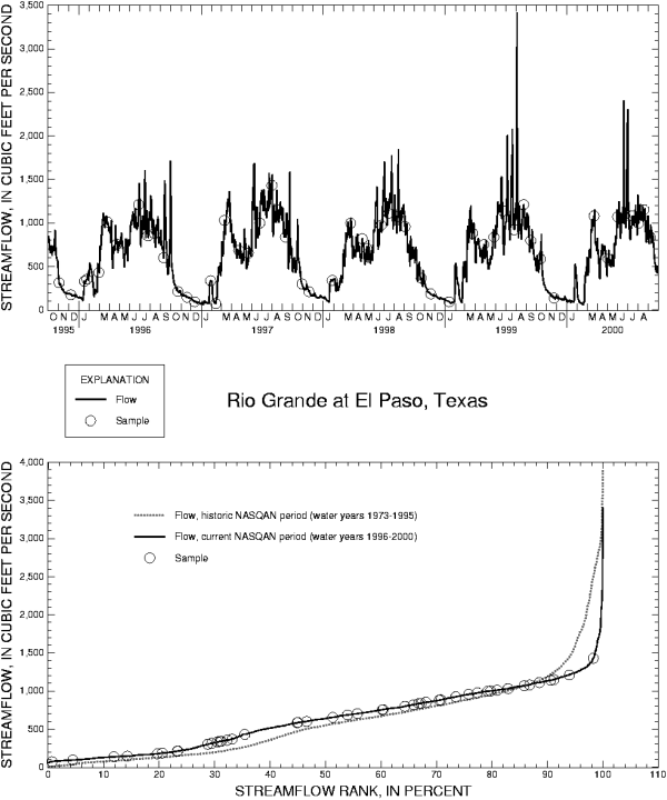
Figures describing hydrographs and sampling
coverage during 1996-2000 for each station can be
viewed by clicking on the appropriate station name in
the following list. The time period for sampling is
defined by the begin date for the period of active
sampling for the specific station (Table 1). A second plot on
each figure depicts the sampling coverage as a
function of the distribution of streamflow, plotted as
rank in percent; for context
with historic NASQAN water-quality data (where data
are available), the distribution of streamflow during
the period of historic NASQAN sampling is also
presented on the same plot.
Download instructions
Mississippi River Basin
-
Ohio River at Greenup Dam near Greenup, Kentucky
-
Ohio River at Cannelton Dam, Kentucky
-
Wabash River at New Harmony, Indiana
-
Tennessee River at Highway 60 near Paducah, Kentucky
-
Ohio River at Lock & Dam 53 near Grand Chain, Illinois
-
Missouri River near Culbertson, Montana
-
Yellowstone River near Sidney, Montana
-
Missouri River at Garrison Dam, North Dakota
-
Missouri River at Pierre, South Dakota
-
Missouri River at Omaha, Nebraska
-
Platte River at Louisville, Nebraska
-
Missouri River at Hermann, Missouri
-
Mississippi River below Grafton, Missouri
-
Mississippi River at Clinton, Iowa
-
Mississippi River at Thebes, Illinois
-
Arkansas River at David Terry Lock & Dam below Little Rock, Arkansas
-
Mississippi River near St. Francisville, Louisiana
-
Lower Atchafalaya River at Melville, Louisiana
Rio Grande Basin
Colorado River Basin
Columbia River Basin
Return to Results