U.S. Geological Survey Data Series 310
1Jacobs Technology Inc., St. Petersburg, FL 33701.
2U.S. Geological Survey, St. Petersburg, FL 33701.
U.S. Department of the Interior
U.S. Geological Survey
Florida Integrated Science Center - St. Petersburg
Publications are available from USGS Information Services, Box 25286, Federal Center, Denver, CO 80225-0046 (telephone 1-888-ASK-USGS; e-mail: infoservices@usgs.gov).
Contents: |
||||
 |
||||
This DVD publication was prepared by an agency of the United States Government. Although these data have been processed successfully on a computer system at the U.S. Geological Survey, no warranty expressed or implied is made regarding the display or utility of the data on any other system, or for general or scientific purposes, nor shall the act of distribution imply any such warranty. The U.S. Geological Survey shall not be held liable for improper or incorrect use of the data described and (or) contained herein. Reference herein to any specific commercial product, process, or service by trade name, trademark, manufacturer, or otherwise does not constitute or imply its endorsement, recommendation, or favoring by the United States Government or any agency thereof.
This disc is readable on any computing platform that has standard DVD driver software installed. The minimum software requirements are a Web browser, Adobe Reader, and a text editor. If you cannot fully access the information on this page, please contact USGS Information Services at infoservices@usgs.gov or 1-888-ASK-USGS. NOTE: The only supported Web browsers that properly display all features of the interactive profiles are Internet Explorer 6 for Windows and Firefox 1.5 for all platforms
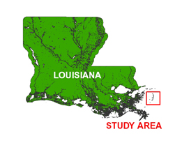
In July of 2006, the U.S. Geological Survey (USGS) conducted a geophysical survey offshore of the Chandeleur Islands, Louisiana, as part of the USGS Barrier Island Coastal Monitoring project (BICM), which is part of a broader study focused on Subsidence and Coastal Change (SCC). This report serves as an archive of unprocessed digital Compressed High Intensity Radar Pulse (CHIRP) seismic reflection data, trackline maps, navigation files, Geographic Information System (GIS) files, Field Activity Collection System (FACS) logs, observer's logbook, and formal Federal Geographic Data Committee (FGDC) metadata. Gained (a relative increase in signal amplitude has been applied) digital images of the seismic profiles are also provided. Refer to the Acronyms page for expansion of acronyms and abbreviations used in this report.
The archived trace data are in standard Society of Exploration Geophysicists (SEG) SEG-Y format (Barry and others, 1975) and may be downloaded and processed with commercial or public domain software such as Seismic Unix (SU). Example SU processing scripts and USGS software for viewing the SEG-Y files (Zihlman, 1992) are also provided.
The original trace files for lines 06c06, 06c07, 06c09, 06c10, 06c35, 06c36, 06c38, 06c48, 06c56, 06c57, 06c67 and 06c68 were divided into two or more trace files each (for example, 06c06 became 06c06_a and 06c06_b) because the original total number of traces exceeded the maximum allowed by the processing software. A problem with the acquisition software caused an abrupt, undetected termination of line 06c31 at shot 6117; therefore, line 06c31 was renamed 06c31a to differentiate it during processing from what was reported in the logs.
The USGS Florida Integrated Science Center (FISC) - St. Petersburg assigns a unique identifier to each cruise or field activity. For example, 06SCC02 tells us the data were collected in 2006 for the Subsidence and Coastal Change (SCC) study and the data were collected during the second field activity for that project in that calendar year. Refer to http://walrus.wr.usgs.gov/infobank/programs/html/definition/activity.html for a detailed description of the method used to assign the field activity ID.
All CHIRP systems use a signal of continuously varying frequency; however, the CHIRP system used during this survey produces a high resolution, shallow penetration (less than 50-ms) profile image beneath the seafloor. The towfish is a sound source and receiver, which is typically towed 2 - 5 m above the seafloor. The acoustic energy is reflected at density boundaries (such as the seafloor or sediment layers beneath the seafloor), detected by a receiver, and recorded by a PC-based seismic acquisition system. This process is repeated at timed intervals (for example, 0.125 s) and recorded for specific intervals of time (for example, 50 ms). In this way, a two-dimensional vertical image of the shallow geologic structure beneath the ship track is produced. Figure 1 displays acquisition geometry. Refer to table 1 for a summary of acquisition parameters. See the digital FACS equipment log (12-KB PDF) for details about the acquisition equipment used. Table 2 lists trackline statistics. Scanned images of the handwritten FACS logs and handwritten science logbook (31-MB PDF) are also provided.
The unprocessed seismic data are stored in SEG-Y format (Barry and others, 1975). See the How To Download SEG-Y Data page for download instructions. The printable profiles provided here are GIF images that were gained using Seismic Unix software. Refer to the Software page for details about the processing and examples of the processing scripts. The processed SEG-Y data were then exported to Chesapeake Technology, Inc. (CTI) SonarWeb software to produce an interactive version of the profile that allows the user to obtain a geographic location and depth from the profile for a cursor position. This information is displayed in the status bar of the browser.
For all browsers, the status bar and JavaScript must be enabled. Firefox also requires "Change status bar text" to be checked under Advanced JavaScript Settings. This option can be found on the main Toolbar under, Tools > Options > Content > Advanced
Allow scripts to:
![]() Change status bar text
Change status bar text
The printable and interactive profiles can be viewed from the Profiles page or from links on the trackline maps. Detailed information about the navigation systems used can be found in table 1 and the FACS equipment log (12-KB PDF). To view the trackline maps and navigation files, and for more information about these items, see the Navigation page.
NOTE: Intermittently during data collection, a vertical striped pattern was observed in the profiles. This anomaly was caused by an acquisition software malfunction that resulted in repetitious zero values for traces when the record length was set to less than 50 ms (fig. 2). The cause of the malfunction was not determined until after the cruise.
NOTE: No navigation fixes were recorded to the SEG-Y headers for tracklines 06c50 - 06c57. To recreate these lines, the navigation data were stripped from coincident sidescan sonar tracklines and merged with the seismic shotpoints to produce the reconstructed navigation shown on the trackline maps and in the navigation files. Lines 06c61 - 06c66 were corrupted and (or) deleted during data collection due to a software malfunction; please see the handwritten operation log (43-KB PDF) for details.
The Disc Contents page is a diagram of the location of all files and folders contained on this disc and provides links to these files and folders. The two discs are identical except for the SEG-Y files. Disc 1 contains SEG-Y files for lines 06c01 through 06c37, and disc 2 contains SEG-Y files for lines 06c38 through 06c93.
To access the information contained on this disc, use a Web browser to open the file index.html. This report is divided into five sections: Navigation Data and Maps, Seismic Profiles, Field Activity Logs, Metadata, and Software. Links at the top and bottom of each page provide access to these sections. This report contains links to the USGS and collaborators or other resources that are only accessible if access to the Internet is available while viewing these documents. NOTE: The only supported Web browsers that properly display all features of the interactive profiles are Internet Explorer 6 for Windows and Firefox 1.5 for all platforms
Funding and (or) support for this study were provided by the USGS Coastal and Marine Geology Program and the University of New Orleans. We thank R/V G.K. Gilbert captains Keith Ludwig and Dave Bennett of the USGS in St. Petersburg, FL, for their assistance in data collection. This document was improved by the reviews of Dick Poore (USGS) and Amar Nayegandhi (ETI) at the FISC - St. Petersburg, FL.
Barry, R.M., Cavers, D.A., and Kneale, C.W., 1975, Recommended standards for digital tape formats: Geophysics, v. 40, no. 2, p. 344-352. Also available online at http://www.seg.org/publications/tech-stand.
Zihlman, F.N., 1992, DUMPSEGY V1.0: A program to examine the contents of SEG-Y disk-image seismic data: U.S. Geological Survey Open-File Report 92-590, 28 p. Also available online at http://pubs.er.usgs.gov/usgspubs/ofr/ofr92590.