 |
|
|
||||
| U.S. Geological Survey Data Series 344 |
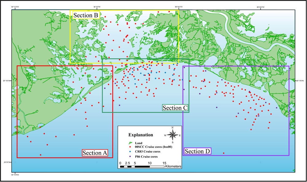
The study area map has been divided into Study Area Map Sections A, B, C, and D moving west to east across the study area. Each core's data are accessible through clicking on the outlined sections on the Study Area Map, or the section links below. Each section is divided into areas that zoom to the vibracore locations. In each location, the vibracores are linked to an interactive core data table (table 1) that contains all vibracore information. In this table, all available data for each core are linked to downloadable files and previews for Vibracore Description Sheets, Interpretive Core Classification Profiles, Grain-Size and Penetrometer Data and Photographs for most cores on the map.
For a map of the USACE EUSTIS borehole cores, click here. The borehole cores on the USACE EUSTIS map are linked to table 1 and contain all borehole core (B-#) information.
Refer to table 1 for a list of all the vibracores for each cruise (CR83, P86, 00SCC) and USACE EUSTIS borehole cores.
Study Area Map Sections |
|
|
|||||
Vibracore MapsVibracore maps were generated with ESRI ArcView 3.3 and ArcGIS 8.3 software, exported to Adobe Illustrator for further editing, and saved in JPEG format. These images can be accessed through the links provided above or from the interactive Study Area Map. All printable maps can be found within the Maps folder in PDF or JPEG format. For more information about the GIS data used to create these maps or the ESRI ArcGIS 8.3 software, refer to the Metadata or Software pages. Note: For information on EUSTIS borehole cores taken within this study area by the USACE, please see the USACE EUSTIS link. These borehole cores have a sample ID of B-# and contain only grain-size and core description sheets. |
|||||||

![]() U.S. Department of the Interior |
U.S. Geological Survey
U.S. Department of the Interior |
U.S. Geological Survey
URL: https://pubsdata.usgs.gov/pubs/ds/344/html/Study_Area_Map.html
Page Contact Information: Publications Team
Page Last Modified: Monday, 28-Nov-2016 13:01:18 EST