| Prev |
| Next |
| Map |
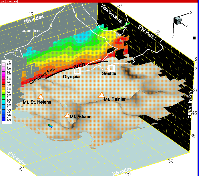
Figure 31--In this and subsequent images, we take a look at north-south cross-sections starting with column 10 in this view. The arch in the JDFP (Juan de Fuca plate) is evident, with some complexity on the south side, where a block of Crescent Fm. rides upon the arch due to regional north-south compression of the Washington coast ranges. On the north side of the arch, the inbricated mafic complex mapped in the last row section is shown. The configuration of accretionary prism sediments in the Olympic Peninsula is more complicated than on column 8 (see previous image) and becomes even more complex as we progress eastward.