| Prev |
| Next |
| Map |
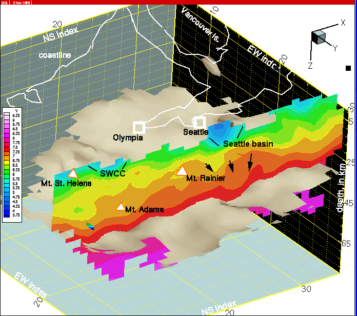
Figure 39--On the column 23 image, the thickness of Seattle basin sedimentary rocks has increased from column 22, possibly related to continued folding of deeper units into the wedge gap. There are no remaining traces of the Tacoma basin. The western margins of the SWCC north of Mt. St. Helens are sampled.