Skip Heading USGS Logo with link to USGS Home Page
  Historic Area Remediation Site (HARS)

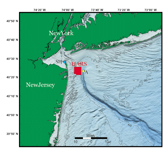
Figure 1. Location map showing the area offshore of New York and New Jersey.

The Historic Area Remediation Site (HARS) is shown in red. Tidal elevations measured at Sandy Hook (SH) and Station A were used to correct the multibeam observations for fluctuations in sea level height during the survey. 20, 40, and 60 meter contours shown on color-coded shaded relief.

Historic Area Remediation Site - Figure 1


Skip Table of Contents Title Page  |  Introduction |  Disposal |  Data Collection |  Maps |  Results |  Summary |  Acknowledgments | 
References |  Poster Format |  Figures/Tables |  GIS Data |  Metadata |  Text in PDF Format | 

[an error occurred while processing this directive]