Making USGS information effective in the electronic age, USGS Open-File Report 03-240
Title Page
Summary
Introduction
Goals
Overview
Outcome
Appendices
I. Agenda
II. Porter: Vision
III. Frodeman:
Earth Science
IV. McDermott/Wendt:
Communications
V. Journeay: CORDlink
VI. MARINCIONI: MRIB
VII. Faust: CMGP
VIII. Brainstorming
IX. Participants
APPENDIX VI - Marine Realms Information Bank (MRIB)
Presentation: F. Marincioni and others - The Example of MRIB
 A USGS Distributed Digital Geolibrary .for the Coastal and Marine Environments
 USGS Coastal and Marine Geology Team
Woods Hole Oceanographic Institution .
Fausto Marincioni
Michael Caruso
Frances Hotchkiss
Andrew Maffei
Rebecca Riall
Steven Lerner
Thomas Aldrich
Gregory Miller
Marine Realms Information Bank
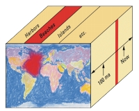
“A distributed geolibrary
is a vision for the future. It would permit users to quickly and easily obtain all existing information available about a place that is relevant to a defined need.
A geolibrary is a digital library filled with geoinformation information associated with a distinct area or footprint on the Earths surface and for which the primary search mechanism is place. A geolibrary is distributed if its users, services, metadata, and information assets can be integrated among many distinct locations.”
National Research Council, 1999. Distributed Geolibraries: Spatial Information Resources.
http://www.nap.edu/html/geolibraries/index.html
Objective | 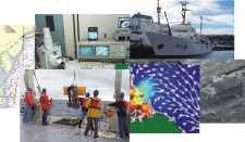 | |
 |
|
Back to Top

Concept
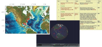
The basis of MRIB is a comprehensive organizational structure that integrates Web-based information from across the USGS coastal and marine program, places it in context, and shows what is known and what is unknown about the marine and coastal environments.
Challenge | 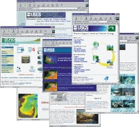 | |
| How can the Web-distributed information about the marine realms be integrated and put into a sensible context? |
Back to Top
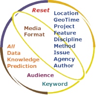
Method | Electronic Index Cards 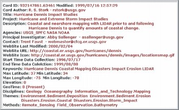 | |
 | ||
If we assign to each information object a metadata profile, .we will be able to efficiently order, search, and sort information available in the Web. Fashioned after old 3x5 library index cards, MRIB EICs allow fast and easy storing of any specifics necessary to consistently classify information objects. | ||
Operational |
||||||||||
|
 |
 |
||||||||
| MRIB is constituted by three independent modules: | ||||||||||
Back to Top
Inserting MRIB METADATA in a Web page ...<html> Here goes the visible part of the Web page 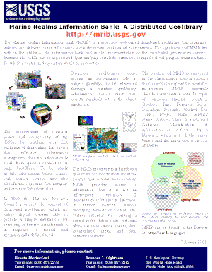
|
||||||||||
Back to Top
