Skip past header information
Link to USGS home page.
U.S. Geological Survey Open-File Report 2004-1435

Early to Middle Jurassic Salt in Baltimore Canyon Trough


skip index. Title Page  /  Abstract  /  Introduction  /   Geologic Setting  /   Data Collection  /  Data Processing  /  Geophysical Analysis  /  Discussion  /  Conclusion  /   Bibliography  /  Figures  /  Tables


Printable PDF Format in 2 Sections: Left and Right.

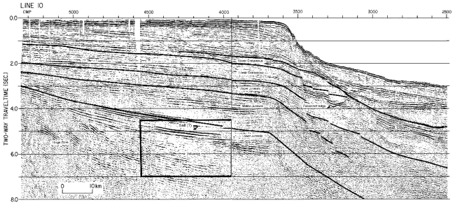
Figure 2C. Interpreted, amplitude-modulated display of wavelet-processed multichannel reflection data. Vertical scale is two-way traveltime in seconds. Boxes show areas enlarged for Figure 3.

Line 10 at the south end of the Baltimore Canyon Trough shows the salt lens seaward of the complex hinge zone and overlying possible volcanic rocks.

Line 10 at the south end of the Baltimore Canyon Trough.


Skip Footer Information
FirstGov button  Take Pride in America button