
|
Geologic Map
The image below shows a simplified map of the geology taken from the map published by Page and others (2005).
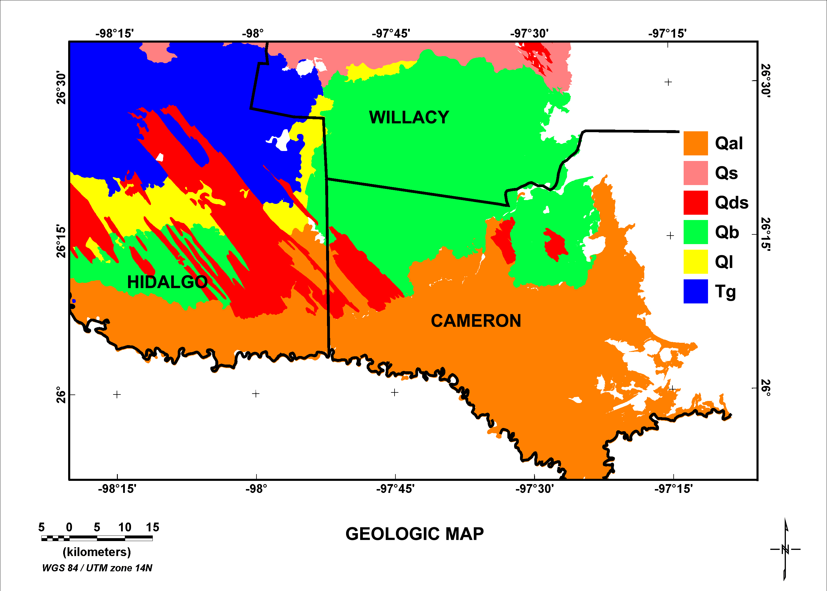
Figure 2. The geologic unit designated as Qal represents Holocene floodplain deposits of the Rio Grande (Qas and Qam units of Page and others, 2005)
that vary from mostly mud to mostly silt and sand. The unit designated as Qs consists of Holocene eolian sand sheet deposits that are mostly sand with little or no relict grain. Unit Qds consists of Holocene eolian sand dunes that are mostly sand with relict eolian grain. Unit Qb represents the undivided Beaumont Formation (Qb, Qbf, and Qbm units of Page and others, 2005)
consisting of Pleistocene deposits of clay, sand, silt, and gravel. Unit Ql is the Pleistocene Lissie Formation consisting of deposits of clay, sand, silt, and gravel and characterized by abundant gravel (Weeks, 1933
). Unit Tg is the Tertiary Goliad Formation (Tg and Tgc units of Page and others, 2005)
consisting of clay, sand, sandstone, marl, caliche, limestone, and conglomerate. Areas shown as white are either bodies of water or areas not included for the purposes of this report. Refer to Page and others (2005)
for additional geologic descriptions and information.
|

